Area Overview for B63 2RP
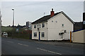
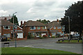
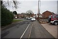
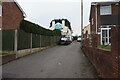
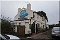
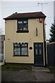
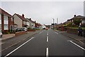
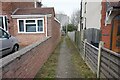
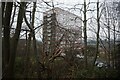
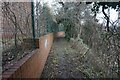
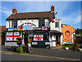
Photos of B63 2RP

Area Information
B63 2RP is a small residential postcode area nestled in the Dudley metropolitan borough, part of the historic Black Country region in England. With a population of 1,848, it lies approximately three miles east of Stourbridge town centre, bordered by Halesowen to the east and rural areas like Lye and Pedmore. The area blends suburban living with historical roots, including Cradley and Wollescote, which were once independent parishes. Today, it features low-rise housing, redeveloped parkland, and remnants of 19th-century industrial heritage. The community is compact, with a focus on local amenities and transport links. Residents benefit from proximity to Stourbridge’s commercial hubs and the surrounding countryside, offering a balance of convenience and tranquillity. The area’s character is shaped by its past as a hub of ironworking and manufacturing, though modern development has shifted toward residential living. For those seeking a quieter, family-oriented environment with access to nearby towns and green spaces, B63 2RP offers a distinct blend of tradition and practicality.
- Area Type
- Postcode
- Area Size
- Not available
- Population
- 1848
- Population Density
- 2680 people/km²
The property market in B63 2RP is characterised by a 57% home ownership rate, indicating a mix of owner-occupied and rental properties. The predominant accommodation type is houses, though the area’s history includes post-war developments featuring flats and former tower blocks. This suggests a varied housing stock, with both standalone homes and multi-unit properties available. As a small postcode area, the market is likely limited in scale, with buyers needing to consider nearby regions for more options. The presence of redeveloped parkland and suburban layouts may appeal to those seeking family-friendly homes with green spaces. However, the area’s compact size means property choices are constrained, and buyers should evaluate proximity to transport links and amenities. The mix of older housing stock and recent developments creates a blend of traditional and modern living, though the market may not cater to high-end or luxury properties.
House Prices in B63 2RP
No properties found in this postcode.
Energy Efficiency in B63 2RP
Living in B63 2RP offers access to a range of local amenities within practical reach. Retail options include major supermarkets like Tesco Lye, Aldi Dudley, and Lidl Cradley, ensuring daily shopping needs are met. The area’s rail stations — Lye, Cradley Heath, and Stourbridge Junction — connect residents to broader transport networks, while metro stops like Dartmouth Street and Lodge Road provide additional mobility. For leisure, Wollescote Hall, a historic site dating to 1508, hosts community events and is managed by local groups. The area’s character includes redeveloped parkland and historic sites like Cradley’s old High Street, offering a mix of green spaces and cultural heritage. While the suburbia is quiet, the proximity to Stourbridge and Halesowen ensures access to larger retail, dining, and entertainment options. The blend of local convenience and regional connectivity makes daily life practical and varied for residents.
Amenities
Schools
| Rank | School | Type | Entry gender | Ages |
|---|
Explore more schools in this area
Go to Schools tabDemographics
The population of B63 2RP has a median age of 47, with the majority of residents falling within the 30-64 age range. This suggests a community of working-age adults and older families, rather than a concentration of younger or retired individuals. Home ownership stands at 57%, indicating a moderate mix of owner-occupied properties and rental homes. The predominant accommodation type is houses, though the area research notes the presence of flats and former tower blocks, particularly in post-war housing estates. The predominant ethnic group is White, though no specific diversity statistics are provided. The relatively high median age and ownership rate suggest a stable, long-term resident base. For those considering the area, the demographic profile points to a mature, settled community with established local networks. The absence of explicit deprivation data means quality of life factors like access to services and employment opportunities should be assessed through local amenities and transport links.
Household Size
Accommodation Type
Tenure
Ethnic Group
Religion
Household Composition
Age
Household Deprivation
NS-SEC
Explore more demographic insights in this area
Go to Demographics tabPlanning
Planning Constraints
- Flood RiskPremium
- Ramsar Wetland SitesPremium
- Area of Outstanding Natural BeautyPremium
- Protected Nature ReservePremium
- Protected WoodlandPremium