Area Overview for DY9 8NX
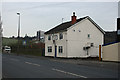
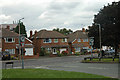
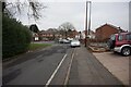
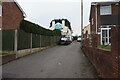
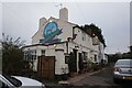
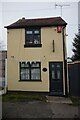
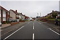
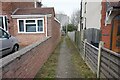
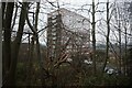
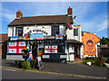
Photos of DY9 8NX

Area Information
DY9 8NX is a small residential postcode in the Dudley metropolitan borough, encompassing parts of Cradley and Wollescote in the West Midlands. With a population of 1,848, it lies approximately three miles east of Stourbridge town centre, nestled within the historic Black Country region. The area is defined by its suburban character, blending low-rise housing with pockets of post-war development. Neighbouring areas include Halesowen to the east and Lye to the west, creating a network of connected communities. Historically, Cradley was a civil parish until 1974, while Wollescote, first mentioned in 1282, retains echoes of its rural past through sites like Wollescote Hall, now a community hub. Daily life here is shaped by proximity to rail links, local retail, and green spaces, offering a balance between suburban convenience and historical roots. The area’s compact size means residents often rely on nearby towns for broader amenities, yet its self-contained nature fosters a tight-knit community feel.
- Area Type
- Postcode
- Area Size
- Not available
- Population
- 1848
- Population Density
- 2680 people/km²
The property market in DY9 8NX is dominated by houses, with 57% of homes owner-occupied. This suggests a stable market where long-term residency is common, though the relatively low home ownership rate (compared to national averages) indicates a notable rental sector. The area’s housing stock includes post-war private and council homes, with some estates like Tanhouse featuring a mix of low-rise properties and former tower blocks. Given the small size of the postcode, buyers may need to consider nearby areas for broader options. The prevalence of houses over flats means the market caters to families and those seeking space, though limited new developments may restrict growth. For buyers, this implies a focus on existing stock, with potential for value retention in well-maintained properties.
House Prices in DY9 8NX
Showing 5 properties
| Address | Type | Beds | Baths | Last Sale Price | Last Sale Date | |
|---|---|---|---|---|---|---|
| Van Monkey Ltd, 7 The Hayes, Lye, DY9 8NX | Office | - | - | - | - | |
| Penn Studio Ltd, 7 The Hayes, Lye, DY9 8NX | Office | - | - | - | - | |
| Aspect Ttm Design Services, 7 The Hayes, Lye, DY9 8NX | Office | - | - | - | - | |
| Torsion Engineering Services Limited, Office 3, 7 The Hayes, Lye, DY9 8NX | Office | - | - | - | - | |
| Ricco Care Ltd, Office 2, 7 The Hayes, Lye, DY9 8NX | Office | - | - | - | - |
Energy Efficiency in DY9 8NX
Living in DY9 8NX offers access to a range of local amenities, including retail outlets like Tesco Lye, Aldi Dudley, and Lidl Cradley, ensuring everyday shopping needs are met. The area’s proximity to rail stations—Lye, Cradley Heath, and Stourbridge Junction—connects residents to broader networks, while metro stops like Dartmouth Street provide links to Birmingham and surrounding towns. Green spaces and historical sites, such as Wollescote Hall and Cradley’s old High Street, add character to daily life. The presence of community-focused venues, like the Friends of Wollescote Park, highlights a strong local culture. While the area lacks large-scale leisure facilities, its compact layout encourages walking and cycling, with nearby parks and open spaces offering recreational opportunities. The blend of practical amenities and historical charm creates a balanced lifestyle for residents.
Amenities
Schools
| Rank | School | Type | Entry gender | Ages |
|---|
Explore more schools in this area
Go to Schools tabDemographics
The population of DY9 8NX is predominantly adults aged 30–64, with a median age of 47, reflecting a mature, stable community. Home ownership stands at 57%, indicating a mix of owner-occupied properties and rentals. The area is characterised by houses rather than flats, aligning with its suburban residential profile. The predominant ethnic group is White, though specific diversity metrics are not detailed in the data. This demographic structure suggests a community focused on long-term residency, with fewer transient populations. The age profile implies a balance between active professionals and retirees, potentially influencing local services and amenities. The absence of significant deprivation data means the area likely avoids the socioeconomic challenges faced by more deprived regions, though this remains unquantified.
Household Size
Accommodation Type
Tenure
Ethnic Group
Religion
Household Composition
Age
Household Deprivation
NS-SEC
Explore more demographic insights in this area
Go to Demographics tabPlanning
Planning Constraints
- Flood RiskPremium
- Ramsar Wetland SitesPremium
- Area of Outstanding Natural BeautyPremium
- Protected Nature ReservePremium
- Protected WoodlandPremium