Area Overview for B47 6AE
Photos of B47 6AE
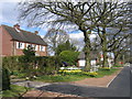
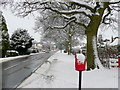
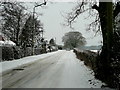
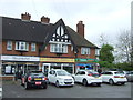
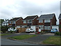
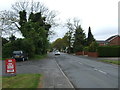
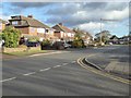
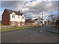
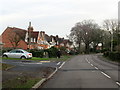
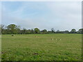
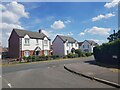
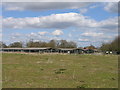
22 photos from this area
Area Information
Key information about the B47 6AE including its size, population, and administrative classification.
- Area Type
- Postcode
- Area Size
- 1.6 hectares
- Population
- 1855
- Population Density
- 922 people/km²
House Prices in B47 6AE
28
Properties
£280,305
Average Sold Price
£78,500
Lowest Price
£435,000
Highest Price
Showing 28 properties
| Address | Type | Beds | Baths | Last Sale Price | Last Sale Date | |
|---|---|---|---|---|---|---|
| 140 Station Road, Wythall, B47 6AE | Detached | 3 | 1 | £435,000 | Nov 2025 | |
| 168 Station Road, Wythall, B47 6AE | Semi-detached | 3 | 1 | £310,000 | Dec 2020 | |
| The Oaks, 182 Station Road, Wythall, B47 6AE | house | 3 | 1 | £375,000 | Dec 2020 | |
| 176 Station Road, Wythall, B47 6AE | Semi-detached | 4 | 1 | £420,000 | Jul 2020 | |
| 146 Station Road, Wythall, B47 6AE | Semi-detached | 4 | 1 | £390,000 | Aug 2016 | |
| 180 Station Road, Wythall, B47 6AE | Semi-detached | 3 | - | £292,000 | Jul 2015 | |
| 188 Station Road, Wythall, B47 6AE | Detached | 4 | 2 | £400,000 | Sep 2013 | |
| 170 Station Road, Wythall, B47 6AE | Semi-detached | 4 | 1 | £263,000 | Jul 2013 | |
| 138 Station Road, Wythall, B47 6AE | house | - | - | £228,000 | Mar 2013 | |
| 142 Station Road, Wythall, B47 6AE | Terraced | - | - | £223,500 | Mar 2012 |
Page 1 of 3
Energy Efficiency in B47 6AE
Amenities
Schools
| Rank | School | Type | Entry gender | Ages |
|---|
Explore more schools in this area
Go to Schools tabDemographics
Household Size
Family (3-5 people)
most common
Accommodation Type
Houses
most common
Tenure
84
majority
Ethnic Group
White
most common
Religion
N/A
most common
Household Composition
N/A
most common
Age
47
median
Adults (30-64 years)
most common
Household Deprivation
N/A
with no deprivation
NS-SEC
47
in Lower managerial occupations
Explore more demographic insights in this area
Go to Demographics tabPlanning
Planning Constraints
- Flood RiskPremium
- Ramsar Wetland SitesPremium
- Area of Outstanding Natural BeautyPremium
- Protected Nature ReservePremium
- Protected WoodlandPremium