Area Overview for B45 8NS
Photos of B45 8NS
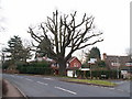
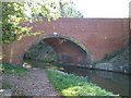
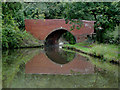
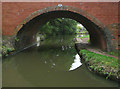
36 photos from this area
Area Information
Key information about the B45 8NS including its size, population, and administrative classification.
- Area Type
- Postcode
- Area Size
- 4.0 hectares
- Population
- 2036
- Population Density
- 682 people/km²
House Prices in B45 8NS
28
Properties
£499,145
Average Sold Price
£135,000
Lowest Price
£915,000
Highest Price
Showing 28 properties
| Address | Type | Beds | Baths | Last Sale Price | Last Sale Date | |
|---|---|---|---|---|---|---|
| 20 Bittell Lane, Barnt Green, B45 8NS | Detached | 4 | 2 | £915,000 | Dec 2023 | |
| 12 Bittell Lane, Barnt Green, B45 8NS | Bungalow | 2 | 1 | £550,000 | Dec 2023 | |
| 6 Bittell Lane, Barnt Green, B45 8NS | Detached | 3 | - | £750,000 | Dec 2020 | |
| 3A Bittell Lane, Barnt Green, B45 8NS | Detached | 4 | - | £660,000 | Sep 2019 | |
| 18 Bittell Lane, Barnt Green, B45 8NS | Detached | 4 | 2 | £785,000 | May 2019 | |
| 10 Bittell Lane, Barnt Green, B45 8NS | house | - | - | £765,000 | Nov 2018 | |
| 17 Bittell Lane, Barnt Green, B45 8NS | Detached | 4 | 2 | £645,000 | Dec 2016 | |
| 20A Bittell Lane, Barnt Green, B45 8NS | house | - | - | £550,000 | Sep 2016 | |
| 2B Bittell Lane, Barnt Green, B45 8NS | Detached | 3 | 2 | £469,950 | Sep 2016 | |
| 22 Bittell Lane, Barnt Green, B45 8NS | Detached | 5 | 1 | £515,000 | Jan 2016 |
Page 1 of 3
Energy Efficiency in B45 8NS
Amenities
Schools
| Rank | School | Type | Entry gender | Ages |
|---|
Explore more schools in this area
Go to Schools tabDemographics
Household Size
Two person
most common
Accommodation Type
Houses
most common
Tenure
85
majority
Ethnic Group
White
most common
Religion
N/A
most common
Household Composition
N/A
most common
Age
47
median
Adults (30-64 years)
most common
Household Deprivation
N/A
with no deprivation
NS-SEC
57
in Lower managerial occupations
Explore more demographic insights in this area
Go to Demographics tabPlanning
Planning Constraints
- Flood RiskPremium
- Ramsar Wetland SitesPremium
- Area of Outstanding Natural BeautyPremium
- Protected Nature ReservePremium
- Protected WoodlandPremium