Area Overview for B45 8NH
Photos of B45 8NH

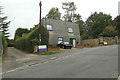

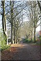

40 photos from this area
Area Information
Key information about the B45 8NH including its size, population, and administrative classification.
- Area Type
- Postcode
- Area Size
- 1.5 hectares
- Population
- 2036
- Population Density
- 682 people/km²
House Prices in B45 8NH
24
Properties
£419,379
Average Sold Price
£195,000
Lowest Price
£690,000
Highest Price
Showing 24 properties
| Address | Type | Beds | Baths | Last Sale Price | Last Sale Date | |
|---|---|---|---|---|---|---|
| 9 Orchard Croft, Barnt Green, B45 8NH | Detached | 3 | 2 | £495,000 | Jul 2025 | |
| 3 Orchard Croft, Barnt Green, B45 8NH | Semi-detached | 3 | 1 | £461,000 | May 2024 | |
| 22 Orchard Croft, Barnt Green, B45 8NH | Bungalow | 3 | 1 | £485,000 | Mar 2024 | |
| 17 Orchard Croft, Barnt Green, B45 8NH | Detached | 5 | 3 | £690,000 | Jan 2024 | |
| 18 Orchard Croft, Barnt Green, B45 8NH | house | 4 | - | £562,000 | Sep 2021 | |
| 22A Orchard Croft, Barnt Green, B45 8NH | Detached | 3 | 2 | £440,000 | Dec 2020 | |
| 25 Orchard Croft, Barnt Green, B45 8NH | Detached | 5 | 3 | £575,000 | Jun 2020 | |
| 20 Orchard Croft, Barnt Green, B45 8NH | Detached | 3 | 1 | £450,000 | Jun 2020 | |
| 10 Orchard Croft, Barnt Green, B45 8NH | Detached | 4 | 2 | £550,000 | Jun 2019 | |
| 21 Orchard Croft, Barnt Green, B45 8NH | Detached | 3 | 1 | £465,000 | Sep 2017 |
Page 1 of 3
Energy Efficiency in B45 8NH
Amenities
Schools
| Rank | School | Type | Entry gender | Ages |
|---|
Explore more schools in this area
Go to Schools tabDemographics
Household Size
Two person
most common
Accommodation Type
Houses
most common
Tenure
85
majority
Ethnic Group
White
most common
Religion
N/A
most common
Household Composition
N/A
most common
Age
47
median
Adults (30-64 years)
most common
Household Deprivation
N/A
with no deprivation
NS-SEC
57
in Lower managerial occupations
Explore more demographic insights in this area
Go to Demographics tabPlanning
Planning Constraints
- Flood RiskPremium
- Ramsar Wetland SitesPremium
- Area of Outstanding Natural BeautyPremium
- Protected Nature ReservePremium
- Protected WoodlandPremium