Area Overview for B45 8NL
Photos of B45 8NL
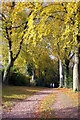
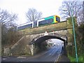
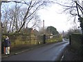
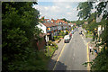
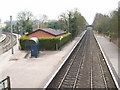
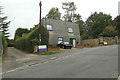
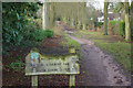
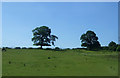
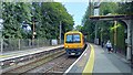
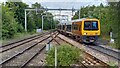
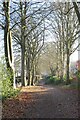
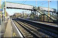
40 photos from this area
Area Information
Key information about the B45 8NL including its size, population, and administrative classification.
- Area Type
- Postcode
- Area Size
- 8658 m²
- Population
- 2036
- Population Density
- 682 people/km²
House Prices in B45 8NL
39
Properties
£314,833
Average Sold Price
£70,000
Lowest Price
£715,000
Highest Price
Showing 39 properties
| Address | Type | Beds | Baths | Last Sale Price | Last Sale Date | |
|---|---|---|---|---|---|---|
| 29 Hewell Road, Barnt Green, B45 8NL | Terraced | 3 | 2 | £261,000 | Nov 2022 | |
| 27 Hewell Road, Barnt Green, B45 8NL | Retail | 5 | 2 | £715,000 | Oct 2022 | |
| 25 Hewell Road, Barnt Green, B45 8NL | house | - | - | £608,000 | Jan 2022 | |
| 35 Hewell Road, Barnt Green, B45 8NL | Terraced | 3 | 1 | £255,000 | Nov 2020 | |
| 71 Hewell Road, Barnt Green, B45 8NL | house | - | - | £312,500 | Jan 2017 | |
| 75 Hewell Road, Barnt Green, B45 8NL | Terraced | 2 | - | £250,000 | Apr 2014 | |
| 73 Hewell Road, Barnt Green, B45 8NL | Terraced | 3 | 1 | £170,000 | Feb 2013 | |
| 69 Hewell Road, Barnt Green, B45 8NL | Flat | - | - | £192,000 | Aug 2010 | |
| 39 Hewell Road, Barnt Green, B45 8NL | house | - | - | £70,000 | Mar 1999 | |
| Flat Over Post Office, 63B Hewell Road, Barnt Green, B45 8NL | Flat | 3 | 1 | - | - |
Page 1 of 4
Energy Efficiency in B45 8NL
Amenities
Schools
| Rank | School | Type | Entry gender | Ages |
|---|
Explore more schools in this area
Go to Schools tabDemographics
Household Size
Two person
most common
Accommodation Type
Houses
most common
Tenure
85
majority
Ethnic Group
White
most common
Religion
N/A
most common
Household Composition
N/A
most common
Age
47
median
Adults (30-64 years)
most common
Household Deprivation
N/A
with no deprivation
NS-SEC
57
in Lower managerial occupations
Explore more demographic insights in this area
Go to Demographics tabPlanning
Planning Constraints
- Flood RiskPremium
- Ramsar Wetland SitesPremium
- Area of Outstanding Natural BeautyPremium
- Protected Nature ReservePremium
- Protected WoodlandPremium