Area Overview for B45 8NX
Photos of B45 8NX
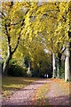

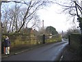
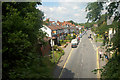
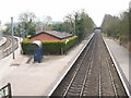
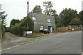
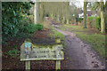
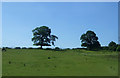


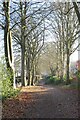

40 photos from this area
Area Information
Key information about the B45 8NX including its size, population, and administrative classification.
- Area Type
- Postcode
- Area Size
- 3.1 hectares
- Population
- 2036
- Population Density
- 682 people/km²
House Prices in B45 8NX
28
Properties
£449,333
Average Sold Price
£119,500
Lowest Price
£870,000
Highest Price
Showing 28 properties
| Address | Type | Beds | Baths | Last Sale Price | Last Sale Date | |
|---|---|---|---|---|---|---|
| 18 Sandhills Lane, Barnt Green, B45 8NX | house | - | - | £870,000 | Jan 2025 | |
| 14 Sandhills Lane, Barnt Green, B45 8NX | Detached | 4 | 2 | £790,000 | Jun 2024 | |
| 38 Sandhills Lane, Barnt Green, B45 8NX | Detached | 4 | 2 | £820,000 | Oct 2023 | |
| 8 Sandhills Lane, Barnt Green, B45 8NX | Terraced | 2 | 1 | £350,000 | May 2022 | |
| 58 Sandhills Lane, Barnt Green, B45 8NX | house | - | - | £797,500 | Dec 2021 | |
| 6 Sandhills Lane, Barnt Green, B45 8NX | house | 2 | 1 | £180,000 | Nov 2020 | |
| 42 Sandhills Lane, Barnt Green, B45 8NX | house | - | - | £553,500 | Nov 2019 | |
| 36 Sandhills Lane, Barnt Green, B45 8NX | Detached | 3 | 2 | £600,000 | Mar 2019 | |
| 54 Sandhills Lane, Barnt Green, B45 8NX | Detached | 4 | 3 | £785,000 | Jan 2018 | |
| 34 Sandhills Lane, Barnt Green, B45 8NX | Detached | 4 | 2 | £615,000 | Jul 2017 |
Page 1 of 3
Energy Efficiency in B45 8NX
Amenities
Schools
| Rank | School | Type | Entry gender | Ages |
|---|
Explore more schools in this area
Go to Schools tabDemographics
Household Size
Two person
most common
Accommodation Type
Houses
most common
Tenure
85
majority
Ethnic Group
White
most common
Religion
N/A
most common
Household Composition
N/A
most common
Age
47
median
Adults (30-64 years)
most common
Household Deprivation
N/A
with no deprivation
NS-SEC
57
in Lower managerial occupations
Explore more demographic insights in this area
Go to Demographics tabPlanning
Planning Constraints
- Flood RiskPremium
- Ramsar Wetland SitesPremium
- Area of Outstanding Natural BeautyPremium
- Protected Nature ReservePremium
- Protected WoodlandPremium