Area Overview for B45 8LY
Photos of B45 8LY
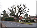
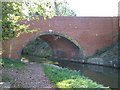
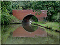
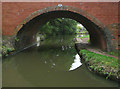
36 photos from this area
Area Information
Key information about the B45 8LY including its size, population, and administrative classification.
- Area Type
- Postcode
- Area Size
- 3.3 hectares
- Population
- 2036
- Population Density
- 682 people/km²
House Prices in B45 8LY
25
Properties
£567,230
Average Sold Price
£215,500
Lowest Price
£842,500
Highest Price
Showing 25 properties
| Address | Type | Beds | Baths | Last Sale Price | Last Sale Date | |
|---|---|---|---|---|---|---|
| 34A Bittell Road, Barnt Green, B45 8LY | Detached | 4 | 2 | £810,000 | Feb 2025 | |
| 72 Bittell Road, Barnt Green, B45 8LY | house | - | - | £825,000 | Dec 2021 | |
| Bittell Cottage, 76 Bittell Road, Barnt Green, B45 8LY | Detached | 4 | - | £625,000 | Dec 2020 | |
| 66 Bittell Road, Barnt Green, B45 8LY | house | - | - | £715,000 | Dec 2020 | |
| 32 Bittell Road, Barnt Green, B45 8LY | Detached | 4 | 2 | £735,000 | Dec 2020 | |
| White Lodge, 34 Bittell Road, Barnt Green, B45 8LY | Detached | 5 | 3 | £842,500 | Dec 2020 | |
| 36 Bittell Road, Barnt Green, B45 8LY | Detached | 4 | 2 | £675,000 | Sep 2017 | |
| 48 Bittell Road, Barnt Green, B45 8LY | Detached | 5 | 3 | £540,000 | Mar 2017 | |
| Brook House, 40A Bittell Road, Barnt Green, B45 8LY | Detached | 5 | - | £575,000 | Feb 2014 | |
| 62 Bittell Road, Barnt Green, B45 8LY | Bungalow | - | - | £380,000 | Dec 2013 |
Page 1 of 3
Energy Efficiency in B45 8LY
Amenities
Schools
| Rank | School | Type | Entry gender | Ages |
|---|
Explore more schools in this area
Go to Schools tabDemographics
Household Size
Two person
most common
Accommodation Type
Houses
most common
Tenure
85
majority
Ethnic Group
White
most common
Religion
N/A
most common
Household Composition
N/A
most common
Age
47
median
Adults (30-64 years)
most common
Household Deprivation
N/A
with no deprivation
NS-SEC
57
in Lower managerial occupations
Explore more demographic insights in this area
Go to Demographics tabPlanning
Planning Constraints
- Flood RiskPremium
- Ramsar Wetland SitesPremium
- Area of Outstanding Natural BeautyPremium
- Protected Nature ReservePremium
- Protected WoodlandPremium