Area Overview for B45 8AA
Photos of B45 8AA
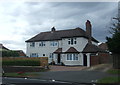
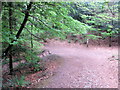
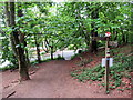
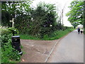
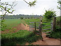
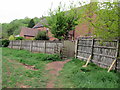
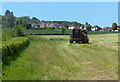
43 photos from this area
Area Information
Key information about the B45 8AA including its size, population, and administrative classification.
- Area Type
- Postcode
- Area Size
- 1.4 hectares
- Population
- 2435
- Population Density
- 1949 people/km²
House Prices in B45 8AA
36
Properties
£286,477
Average Sold Price
£63,000
Lowest Price
£418,000
Highest Price
Showing 36 properties
| Address | Type | Beds | Baths | Last Sale Price | Last Sale Date | |
|---|---|---|---|---|---|---|
| 26 Ashmead Drive, Cofton Hackett, B45 8AA | Semi-detached | 3 | 2 | £322,000 | Aug 2025 | |
| 11 Ashmead Drive, Cofton Hackett, B45 8AA | Semi-detached | 3 | 1 | £365,000 | Oct 2024 | |
| 30 Ashmead Drive, Cofton Hackett, B45 8AA | Semi-detached | 3 | 2 | £315,000 | Sep 2024 | |
| 9 Ashmead Drive, Cofton Hackett, B45 8AA | Semi-detached | 3 | 1 | £390,000 | Sep 2024 | |
| 22 Ashmead Drive, Cofton Hackett, B45 8AA | Semi-detached | 3 | 1 | £418,000 | Sep 2024 | |
| 24 Ashmead Drive, Cofton Hackett, B45 8AA | Semi-detached | 3 | 1 | £385,000 | May 2024 | |
| 28 Ashmead Drive, Cofton Hackett, B45 8AA | Semi-detached | 3 | 1 | £365,000 | Dec 2022 | |
| 29 Ashmead Drive, Cofton Hackett, B45 8AA | Semi-detached | 3 | 1 | £350,000 | Nov 2022 | |
| 23 Ashmead Drive, Cofton Hackett, B45 8AA | Semi-detached | 3 | 1 | £365,000 | Mar 2022 | |
| 7 Ashmead Drive, Cofton Hackett, B45 8AA | Semi-detached | 3 | 1 | £335,000 | Nov 2021 |
Page 1 of 4
Energy Efficiency in B45 8AA
Amenities
Schools
| Rank | School | Type | Entry gender | Ages |
|---|
Explore more schools in this area
Go to Schools tabDemographics
Household Size
Family (3-5 people)
most common
Accommodation Type
Houses
most common
Tenure
90
majority
Ethnic Group
White
most common
Religion
N/A
most common
Household Composition
N/A
most common
Age
47
median
Adults (30-64 years)
most common
Household Deprivation
N/A
with no deprivation
NS-SEC
53
in Lower managerial occupations
Explore more demographic insights in this area
Go to Demographics tabPlanning
Planning Constraints
- Flood RiskPremium
- Ramsar Wetland SitesPremium
- Area of Outstanding Natural BeautyPremium
- Protected Nature ReservePremium
- Protected WoodlandPremium