Area Overview for B45 8PE
Photos of B45 8PE
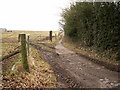
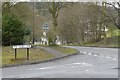
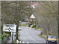
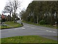
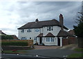
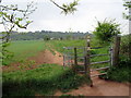
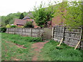
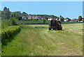
43 photos from this area
Area Information
Key information about the B45 8PE including its size, population, and administrative classification.
- Area Type
- Postcode
- Area Size
- 3.1 hectares
- Population
- 2435
- Population Density
- 1949 people/km²
House Prices in B45 8PE
36
Properties
£353,826
Average Sold Price
£88,500
Lowest Price
£724,950
Highest Price
Showing 36 properties
| Address | Type | Beds | Baths | Last Sale Price | Last Sale Date | |
|---|---|---|---|---|---|---|
| 30 Ten Ashes Lane, Cofton Hackett, B45 8PE | Retail | 3 | 1 | £530,000 | Nov 2022 | |
| 38 Ten Ashes Lane, Cofton Hackett, B45 8PE | house | - | - | £505,000 | Sep 2022 | |
| 32 Ten Ashes Lane, Cofton Hackett, B45 8PE | house | - | - | £419,000 | Sep 2021 | |
| 46A Ten Ashes Lane, Cofton Hackett, B45 8PE | Detached | 4 | 3 | £625,000 | Sep 2021 | |
| 40 Ten Ashes Lane, Cofton Hackett, B45 8PE | Semi-detached | 5 | 4 | £350,000 | May 2021 | |
| 17 Ten Ashes Lane, Cofton Hackett, B45 8PE | house | - | - | £290,000 | Nov 2020 | |
| 44 Ten Ashes Lane, Cofton Hackett, B45 8PE | Bungalow | 4 | 3 | £599,000 | Sep 2020 | |
| 3 Ten Ashes Lane, Cofton Hackett, B45 8PE | Semi-detached | 4 | 2 | £337,000 | Aug 2020 | |
| 5 Ten Ashes Lane, Cofton Hackett, B45 8PE | Semi-detached | 3 | 1 | £287,500 | Mar 2020 | |
| 4 Ten Ashes Lane, Cofton Hackett, B45 8PE | Semi-detached | 5 | 1 | £320,000 | Sep 2018 |
Page 1 of 4
Energy Efficiency in B45 8PE
Amenities
Schools
| Rank | School | Type | Entry gender | Ages |
|---|
Explore more schools in this area
Go to Schools tabDemographics
Household Size
Family (3-5 people)
most common
Accommodation Type
Houses
most common
Tenure
90
majority
Ethnic Group
White
most common
Religion
N/A
most common
Household Composition
N/A
most common
Age
47
median
Adults (30-64 years)
most common
Household Deprivation
N/A
with no deprivation
NS-SEC
53
in Lower managerial occupations
Explore more demographic insights in this area
Go to Demographics tabPlanning
Planning Constraints
- Flood RiskPremium
- Ramsar Wetland SitesPremium
- Area of Outstanding Natural BeautyPremium
- Protected Nature ReservePremium
- Protected WoodlandPremium