Area Overview for B45 0NP
Photos of B45 0NP
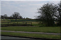
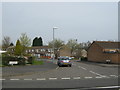
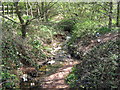
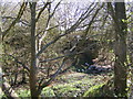
21 photos from this area
Area Information
Key information about the B45 0NP including its size, population, and administrative classification.
- Area Type
- Postcode
- Area Size
- 1.5 hectares
- Population
- 1325
- Population Density
- 4942 people/km²
House Prices in B45 0NP
49
Properties
£108,875
Average Sold Price
£38,500
Lowest Price
£199,000
Highest Price
Showing 49 properties
| Address | Type | Beds | Baths | Last Sale Price | Last Sale Date | |
|---|---|---|---|---|---|---|
| 22 Devon Road, Birmingham, B45 0NP | Terraced | 5 | 2 | £199,000 | Jan 2025 | |
| 24 Devon Road, Birmingham, B45 0NP | house | 1 | 1 | £170,000 | Dec 2021 | |
| 86 Devon Road, Birmingham, B45 0NP | Terraced | 3 | 1 | £141,000 | Oct 2021 | |
| 20 Devon Road, Birmingham, B45 0NP | Semi-detached | 3 | 1 | £136,000 | Apr 2019 | |
| 68 Devon Road, Birmingham, B45 0NP | Terraced | 4 | 2 | £139,000 | Nov 2018 | |
| 6 Devon Road, Birmingham, B45 0NP | Terraced | 2 | 1 | £120,000 | Jan 2018 | |
| 40 Devon Road, Birmingham, B45 0NP | Terraced | 3 | 1 | £105,000 | May 2015 | |
| 96 Devon Road, Birmingham, B45 0NP | Flat | - | - | £60,000 | Aug 2014 | |
| 60 Devon Road, Birmingham, B45 0NP | Detached | - | - | £107,000 | May 2007 | |
| 92 Devon Road, Birmingham, B45 0NP | Flat | - | - | £48,000 | Apr 2003 |
Page 1 of 5
Energy Efficiency in B45 0NP
Amenities
Schools
| Rank | School | Type | Entry gender | Ages |
|---|
Explore more schools in this area
Go to Schools tabDemographics
Household Size
One person
most common
Accommodation Type
Houses
most common
Tenure
45
majority
Ethnic Group
White
most common
Religion
N/A
most common
Household Composition
N/A
most common
Age
47
median
Adults (30-64 years)
most common
Household Deprivation
N/A
with no deprivation
NS-SEC
15
in Lower managerial occupations
Explore more demographic insights in this area
Go to Demographics tabPlanning
Planning Constraints
- Flood RiskPremium
- Ramsar Wetland SitesPremium
- Area of Outstanding Natural BeautyPremium
- Protected Nature ReservePremium
- Protected WoodlandPremium