Area Overview for B44 9TB
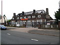
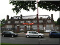
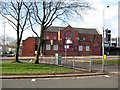
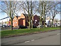
Photos of B44 9TB

Area Information
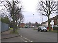
Living in B44 9TB means residing in a specific postcode cluster within the wider Kingstanding neighbourhood. This small residential area spans just 5113 square metres but houses 1471 people. The high population density of 287,685 people per square kilometre indicates a tightly packed living environment typical of established suburbs. Kingstanding itself developed quickly from farmland in the late 1920s, transforming into a large residential estate with amenities added by 1939. You will find the area centred on the junction of Kingstanding Road and Kings Road, encompassing landmarks like Witton Lakes and Perry Common parts of the local landscape. The character of the neighbourhood reflects its rapid expansion in the 1928 period, creating a distinct community identity separate from the surrounding city centre. Homes in B44 9TB offer a slice of this planned suburban history where council housing estates once dominated the local skyline before being completed around 1930. Residents today benefit from historic infrastructure including the former Odeon cinema on Kingstanding Circle and the Kingstanding Library which opened in 1964. This postcode serves as a snapshot of a neighbourhood that balanced rural heritage with modern urban needs decades ago.
- Area Type
- Postcode
- Area Size
- 5113 m²
- Population
- 1471
- Population Density
- 7763 people/km²
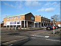
The property market in B44 9TB is characterised by a mix of family homes and established estates. Houses form the primary accommodation type in this postcode, offering significant space compared to the density of nearby city centres. The fact that 53 per cent of residents are homeowners indicates that this is an owner-occupied area rather than a heavy rental market. You will find fewer purpose-built rental blocks here, largely because the housing was constructed as single-family units during the major development phase from 1928 to the 1930s. Although the postcode is small at only 5113 square metres, it contains enough residential units to support over 1,400 people, creating a functional micro-community. Potential buyers looking specifically at homes in B44 9TB should expect properties to be part of the larger Kingstanding estate network described in local records. The estate was designed entirely as a residential zone with no factories, meaning the immediate streetscape is free from industrial noise or heavy traffic associated with manufacturing. This design choice has preserved the residential character of the area for nearly a century. When searching for flats in B44 9TB, options may be limited compared to the number of houses available. The market reflects a clear preference for traditional suburban living styles over high-rise urban condos.
House Prices in B44 9TB
No properties found in this postcode.
Energy Efficiency in B44 9TB
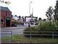
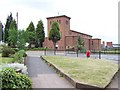
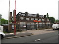
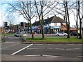
Daily life in B44 9TB benefits from a strong concentration of retail and transport amenities within short reach. You will find five retail locations nearby, including major chains like Iceland Kingstanding and both Co-op branches on Kingstanding Road and Dyas. These shops provide essential provisions and local services without the need for lengthy trips into the city centre. For commuters, the area boasts five railway stations and five metro stops at your fingertips. Specific stops like Wylde Green Railway Station and Soho Benson Road allow for flexible travel patterns depending on your work location. Beyond shopping and transport, the area research highlights notable landmarks that contribute to the local character. St Luke's Church, which opened in 1937, stands as a historic focal point alongside the Kingstanding Library established in 1964. Residents also have access to Kingstanding Circle, which historically housed an Odeon cinema opened in 1935. The presence of multiple places of worship including St Mark's and Ebenezer Memorial chapel adds to the social fabric of the neighbourhood. These amenities are not just functional but define the community identity of Kingstanding and its surrounding wards.
Amenities
Schools
| Rank | School | Type | Entry gender | Ages |
|---|
Explore more schools in this area
Go to Schools tabDemographics
The community in B44 9TB is defined by a mature resident base with a median age of 47 years. Most households fall within the adult age range of 30 to 64 years, suggesting a population focused on mid-life stability rather than young families or retirees. Over half of all residents, specifically 53 per cent, own their homes outright or with a mortgage. This high ownership rate contrasts with the typical rental-heavy markets found in larger urban centres. The area predominantly features detached or semi-detached houses rather than flats or apartments, aligning with the historical development of council housing estates in the region. The demographic profile indicates a stable, long-term community where many families have roots in the neighbourhood going back to the post-World War II era. The predominant ethnic group in B44 9TB is White, reflecting the original settlement patterns of the Kingstanding estates. With such a focused age profile, you can expect neighbourhood activities to cater to active adults and growing families. The consistency of these figures suggests a quiet environment where residents know their neighbours well.
Household Size
Accommodation Type
Tenure
Ethnic Group
Religion
Household Composition
Age
Household Deprivation
NS-SEC
Explore more demographic insights in this area
Go to Demographics tabPlanning
Planning Constraints
- Flood RiskPremium
- Ramsar Wetland SitesPremium
- Area of Outstanding Natural BeautyPremium
- Protected Nature ReservePremium
- Protected WoodlandPremium