Area Overview for B44 0UB
Photos of B44 0UB
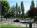
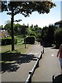
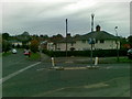
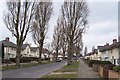
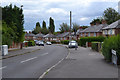
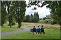
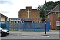
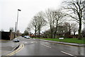
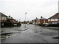
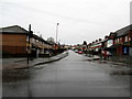
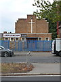
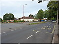
38 photos from this area
Area Information
Key information about the B44 0UB including its size, population, and administrative classification.
- Area Type
- Postcode
- Area Size
- 9324 m²
- Population
- 1471
- Population Density
- 7763 people/km²
House Prices in B44 0UB
24
Properties
£113,545
Average Sold Price
£39,000
Lowest Price
£198,000
Highest Price
Showing 24 properties
| Address | Type | Beds | Baths | Last Sale Price | Last Sale Date | |
|---|---|---|---|---|---|---|
| 69 Harringay Road, Birmingham, B44 0UB | house | - | - | £197,500 | Mar 2025 | |
| 71 Harringay Road, Birmingham, B44 0UB | Retail | 3 | 1 | £198,000 | Apr 2022 | |
| 51 Harringay Road, Birmingham, B44 0UB | house | - | - | £156,000 | Jan 2021 | |
| 79 Harringay Road, Birmingham, B44 0UB | house | - | - | £118,000 | Jan 2020 | |
| 47 Harringay Road, Birmingham, B44 0UB | house | - | - | £102,000 | Aug 2006 | |
| 57 Harringay Road, Birmingham, B44 0UB | house | - | - | £85,000 | Feb 2005 | |
| 81 Harringay Road, Birmingham, B44 0UB | Semi-detached | - | - | £136,950 | Oct 2004 | |
| 67 Harringay Road, Birmingham, B44 0UB | Terraced | - | - | £60,000 | Jul 2002 | |
| 77 Harringay Road, Birmingham, B44 0UB | house | - | - | £39,000 | Jan 2002 | |
| 49 Harringay Road, Birmingham, B44 0UB | Terraced | - | - | £43,000 | Sep 2001 |
Page 1 of 3
Energy Efficiency in B44 0UB
Amenities
Schools
| Rank | School | Type | Entry gender | Ages |
|---|
Explore more schools in this area
Go to Schools tabDemographics
Household Size
Family (3-5 people)
most common
Accommodation Type
Houses
most common
Tenure
53
majority
Ethnic Group
White
most common
Religion
N/A
most common
Household Composition
N/A
most common
Age
47
median
Adults (30-64 years)
most common
Household Deprivation
N/A
with no deprivation
NS-SEC
13
in Lower managerial occupations
Explore more demographic insights in this area
Go to Demographics tabPlanning
Planning Constraints
- Flood RiskPremium
- Ramsar Wetland SitesPremium
- Area of Outstanding Natural BeautyPremium
- Protected Nature ReservePremium
- Protected WoodlandPremium