Area Overview for B44 0UD
Photos of B44 0UD
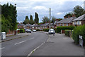
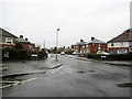
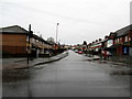
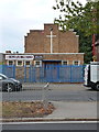
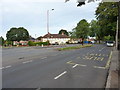
38 photos from this area
Area Information
Key information about the B44 0UD including its size, population, and administrative classification.
- Area Type
- Postcode
- Area Size
- 1.2 hectares
- Population
- 1376
- Population Density
- 7141 people/km²
House Prices in B44 0UD
34
Properties
£87,913
Average Sold Price
£38,500
Lowest Price
£175,000
Highest Price
Showing 34 properties
| Address | Type | Beds | Baths | Last Sale Price | Last Sale Date | |
|---|---|---|---|---|---|---|
| 25 Streatham Grove, Birmingham, B44 0UD | Terraced | 3 | 1 | £175,000 | Dec 2022 | |
| 16 Streatham Grove, Birmingham, B44 0UD | Terraced | 3 | 1 | £116,500 | Jun 2017 | |
| 2 Streatham Grove, Birmingham, B44 0UD | Terraced | 3 | 1 | £122,000 | Sep 2016 | |
| 5 Streatham Grove, Birmingham, B44 0UD | house | - | - | £68,000 | May 2011 | |
| 1 Streatham Grove, Birmingham, B44 0UD | house | 3 | - | £74,000 | Nov 2010 | |
| 18 Streatham Grove, Birmingham, B44 0UD | house | 3 | - | £111,000 | Jul 2007 | |
| 24 Streatham Grove, Birmingham, B44 0UD | house | 3 | 1 | £107,000 | Sep 2006 | |
| 15 Streatham Grove, Birmingham, B44 0UD | Terraced | - | - | £100,000 | Jun 2006 | |
| 34 Streatham Grove, Birmingham, B44 0UD | house | - | - | £61,000 | Nov 2002 | |
| 33 Streatham Grove, Birmingham, B44 0UD | Semi-detached | - | - | £43,000 | Dec 1999 |
Page 1 of 4
Energy Efficiency in B44 0UD
Amenities
Schools
| Rank | School | Type | Entry gender | Ages |
|---|
Explore more schools in this area
Go to Schools tabDemographics
Household Size
Family (3-5 people)
most common
Accommodation Type
Houses
most common
Tenure
45
majority
Ethnic Group
White
most common
Religion
N/A
most common
Household Composition
N/A
most common
Age
47
median
Adults (30-64 years)
most common
Household Deprivation
N/A
with no deprivation
NS-SEC
15
in Lower managerial occupations
Explore more demographic insights in this area
Go to Demographics tabPlanning
Planning Constraints
- Flood RiskPremium
- Ramsar Wetland SitesPremium
- Area of Outstanding Natural BeautyPremium
- Protected Nature ReservePremium
- Protected WoodlandPremium