Area Overview for B42 1HQ
Photos of B42 1HQ
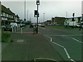
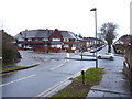
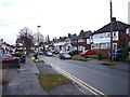

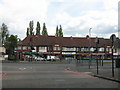
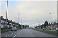
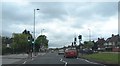
17 photos from this area
Area Information
Key information about the B42 1HQ including its size, population, and administrative classification.
- Area Type
- Postcode
- Area Size
- 1.4 hectares
- Population
- 1662
- Population Density
- 7115 people/km²
House Prices in B42 1HQ
46
Properties
£118,770
Average Sold Price
£2,780
Lowest Price
£225,000
Highest Price
Showing 46 properties
| Address | Type | Beds | Baths | Last Sale Price | Last Sale Date | |
|---|---|---|---|---|---|---|
| 85 Dyas Avenue, Birmingham, B42 1HQ | Semi-detached | 3 | 1 | £165,000 | Oct 2025 | |
| 63 Dyas Avenue, Birmingham, B42 1HQ | Semi-detached | 3 | 1 | £225,000 | Nov 2024 | |
| 61 Dyas Avenue, Birmingham, B42 1HQ | house | - | - | £187,000 | Feb 2023 | |
| 109 Dyas Avenue, Birmingham, B42 1HQ | house | 3 | 1 | £192,500 | May 2022 | |
| 57 Dyas Avenue, Birmingham, B42 1HQ | Detached | 3 | - | £2,780 | Oct 2021 | |
| 113 Dyas Avenue, Birmingham, B42 1HQ | house | 3 | - | £183,500 | Oct 2020 | |
| 105 Dyas Avenue, Birmingham, B42 1HQ | Semi-detached | 3 | 1 | £198,500 | Jun 2020 | |
| 83 Dyas Avenue, Birmingham, B42 1HQ | Semi-detached | 3 | 2 | £155,000 | Jul 2019 | |
| 71 Dyas Avenue, Birmingham, B42 1HQ | Semi-detached | 3 | 1 | £127,000 | Apr 2018 | |
| 67 Dyas Avenue, Birmingham, B42 1HQ | Semi-detached | 3 | - | £130,000 | Mar 2018 |
Page 1 of 5
Energy Efficiency in B42 1HQ
Amenities
Schools
| Rank | School | Type | Entry gender | Ages |
|---|
Explore more schools in this area
Go to Schools tabDemographics
Household Size
Family (3-5 people)
most common
Accommodation Type
Houses
most common
Tenure
78
majority
Ethnic Group
White
most common
Religion
N/A
most common
Household Composition
N/A
most common
Age
47
median
Adults (30-64 years)
most common
Household Deprivation
N/A
with no deprivation
NS-SEC
27
in Lower managerial occupations
Explore more demographic insights in this area
Go to Demographics tabPlanning
Planning Constraints
- Flood RiskPremium
- Ramsar Wetland SitesPremium
- Area of Outstanding Natural BeautyPremium
- Protected Nature ReservePremium
- Protected WoodlandPremium