Area Overview for B42 1HA
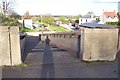
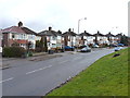
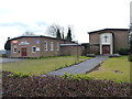
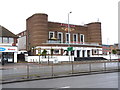
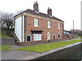
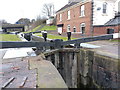
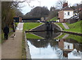
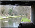
Photos of B42 1HA
Area Information
Living in B42 1HA means being part of a small, tightly knit residential cluster in north Birmingham, a suburb with roots in ancient manors recorded in the Domesday Book. The area’s population of 1,662 residents reflects a mature community, with a median age of 47 and a strong presence of adults aged 30–64. Historically, Perry Barr was a civil parish before merging with Birmingham in 1930, and its name derives from Old English and Celtic roots—“pear tree” and “hill top.” Today, the area is defined by its proximity to landmarks like the Birmingham Crematorium (opened in 1903) and the former Odeon cinema, now a conference venue. Daily life here balances suburban tranquillity with urban accessibility, with rail and metro stations within practical reach. The area’s compact size means residents are close to amenities, from local shops to transport hubs, while its integration into Birmingham’s infrastructure ensures connectivity to the wider region. For those seeking a community with historical depth and modern convenience, B42 1HA offers a distinctive blend of heritage and practicality.
- Area Type
- Postcode
- Area Size
- Not available
- Population
- 1662
- Population Density
- 7115 people/km²
The property market in B42 1HA is dominated by owner-occupied homes, with 78% of residents living in properties they own. The area’s housing stock is primarily composed of houses rather than flats, a feature typical of suburban developments. This suggests a market skewed towards long-term residents rather than short-term renters, offering buyers a sense of permanence and community stability. The compact nature of the postcode means the housing stock is limited, but the high home ownership rate indicates strong demand for existing properties. For buyers, this translates to a market where properties are likely to hold value, though the small area size means competition for available homes. The absence of large-scale regeneration projects or new developments implies a relatively static market, with property values influenced more by location and condition than by speculative growth.
House Prices in B42 1HA
No properties found in this postcode.
Energy Efficiency in B42 1HA
Residents of B42 1HA have access to a range of amenities within practical reach, enhancing daily life. Local retail options include Co-op Walsall, Lidl Birmingham, and Tesco Great, providing essential shopping needs. The area’s transport links are a key feature, with rail stations such as Hamstead, Perry Barr, and Witton offering connections to Birmingham and surrounding areas, while metro stations like Winson Green Outer Circle and Handsworth Booth Street provide additional mobility. The presence of these stations ensures that residents can easily access employment, education, and leisure opportunities. The area’s historical character, combined with modern convenience, creates a lifestyle that balances suburban comfort with urban accessibility.
Amenities
Schools
| Rank | School | Type | Entry gender | Ages |
|---|
Explore more schools in this area
Go to Schools tabDemographics
The community in B42 1HA is predominantly composed of adults aged 30–64, with a median age of 47. Home ownership is high at 78%, indicating a stable, long-term resident base. The area is characterised by a predominance of houses rather than flats, reflecting a traditional suburban layout. The predominant ethnic group is White, though specific diversity metrics are not provided. This age profile suggests a population focused on family life and established careers, with fewer young families or retirees compared to other areas. The low deprivation levels implied by the high home ownership rate likely contribute to a quality of life marked by stability and access to local services. The absence of detailed data on household types or income brackets means the community’s social dynamics remain partially unexplored, but the demographic trends point to a cohesive, middle-aged population with strong ties to the area.
Household Size
Accommodation Type
Tenure
Ethnic Group
Religion
Household Composition
Age
Household Deprivation
NS-SEC
Explore more demographic insights in this area
Go to Demographics tabPlanning
Planning Constraints
- Flood RiskPremium
- Ramsar Wetland SitesPremium
- Area of Outstanding Natural BeautyPremium
- Protected Nature ReservePremium
- Protected WoodlandPremium