Area Overview for B42 1HE
Photos of B42 1HE

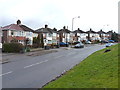
39 photos from this area
Area Information
Key information about the B42 1HE including its size, population, and administrative classification.
- Area Type
- Postcode
- Area Size
- 1.4 hectares
- Population
- 1472
- Population Density
- 4837 people/km²
House Prices in B42 1HE
27
Properties
£201,672
Average Sold Price
£76,000
Lowest Price
£330,000
Highest Price
Showing 27 properties
| Address | Type | Beds | Baths | Last Sale Price | Last Sale Date | |
|---|---|---|---|---|---|---|
| 48 Dyas Avenue, Birmingham, B42 1HE | Semi-detached | 3 | 1 | £290,000 | Mar 2025 | |
| 62 Dyas Avenue, Birmingham, B42 1HE | Semi-detached | 3 | 1 | £240,000 | May 2024 | |
| 58 Dyas Avenue, Birmingham, B42 1HE | house | - | - | £317,000 | Apr 2024 | |
| 16 Dyas Avenue, Birmingham, B42 1HE | house | - | - | £330,000 | Aug 2022 | |
| 32 Dyas Avenue, Birmingham, B42 1HE | house | - | - | £200,000 | Mar 2017 | |
| 20 Dyas Avenue, Birmingham, B42 1HE | house | - | - | £150,000 | Jul 2016 | |
| 22 Dyas Avenue, Birmingham, B42 1HE | Semi-detached | 5 | 1 | £240,000 | Mar 2016 | |
| 46 Dyas Avenue, Birmingham, B42 1HE | house | - | - | £192,000 | Sep 2013 | |
| 24 Dyas Avenue, Birmingham, B42 1HE | house | 3 | - | £144,750 | Oct 2012 | |
| 18 Dyas Avenue, Birmingham, B42 1HE | Semi-detached | 1 | 4 | £150,000 | Mar 2011 |
Page 1 of 3
Energy Efficiency in B42 1HE
Amenities
Schools
| Rank | School | Type | Entry gender | Ages |
|---|
Explore more schools in this area
Go to Schools tabDemographics
Household Size
Family (3-5 people)
most common
Accommodation Type
Houses
most common
Tenure
60
majority
Ethnic Group
White
most common
Religion
N/A
most common
Household Composition
N/A
most common
Age
47
median
Adults (30-64 years)
most common
Household Deprivation
N/A
with no deprivation
NS-SEC
23
in Lower managerial occupations
Explore more demographic insights in this area
Go to Demographics tabPlanning
Planning Constraints
- Flood RiskPremium
- Ramsar Wetland SitesPremium
- Area of Outstanding Natural BeautyPremium
- Protected Nature ReservePremium
- Protected WoodlandPremium