Area Overview for B38 8TN
Photos of B38 8TN
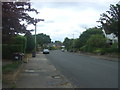
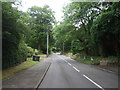
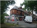
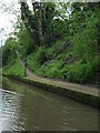
49 photos from this area
Area Information
Key information about the B38 8TN including its size, population, and administrative classification.
- Area Type
- Postcode
- Area Size
- 1.2 hectares
- Population
- 1369
- Population Density
- 1317 people/km²
House Prices in B38 8TN
13
Properties
£304,145
Average Sold Price
£159,950
Lowest Price
£550,000
Highest Price
Showing 13 properties
| Address | Type | Beds | Baths | Last Sale Price | Last Sale Date | |
|---|---|---|---|---|---|---|
| 46 Westhill Road, Birmingham, B38 8TN | Semi-detached | 4 | 1 | £550,000 | Sep 2025 | |
| 52 Westhill Road, Birmingham, B38 8TN | house | 3 | 1 | £460,000 | Dec 2022 | |
| 56 Westhill Road, Birmingham, B38 8TN | Semi-detached | 4 | 1 | £360,000 | Jan 2020 | |
| 24 Westhill Road, Birmingham, B38 8TN | Detached | 3 | 1 | £239,000 | Sep 2019 | |
| 54 Westhill Road, Birmingham, B38 8TN | Semi-detached | 3 | - | £275,000 | Nov 2015 | |
| 62 Westhill Road, Birmingham, B38 8TN | house | - | - | £287,500 | Oct 2015 | |
| 28 Westhill Road, Birmingham, B38 8TN | Semi-detached | 3 | 1 | £175,000 | Oct 2010 | |
| 60 Westhill Road, Birmingham, B38 8TN | Semi-detached | - | - | £250,000 | Jan 2008 | |
| 26 Westhill Road, Birmingham, B38 8TN | Semi-detached | 4 | - | £159,950 | Apr 2005 | |
| 64 Westhill Road, Birmingham, B38 8TN | Semi-detached | - | - | £285,000 | Apr 2005 |
Page 1 of 2
Energy Efficiency in B38 8TN
Amenities
Schools
| Rank | School | Type | Entry gender | Ages |
|---|
Explore more schools in this area
Go to Schools tabDemographics
Household Size
Two person
most common
Accommodation Type
Houses
most common
Tenure
90
majority
Ethnic Group
White
most common
Religion
N/A
most common
Household Composition
N/A
most common
Age
47
median
Adults (30-64 years)
most common
Household Deprivation
N/A
with no deprivation
NS-SEC
49
in Lower managerial occupations
Explore more demographic insights in this area
Go to Demographics tabPlanning
Planning Constraints
- Flood RiskPremium
- Ramsar Wetland SitesPremium
- Area of Outstanding Natural BeautyPremium
- Protected Nature ReservePremium
- Protected WoodlandPremium