Area Overview for B38 8TJ
Photos of B38 8TJ

Area Information
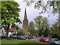
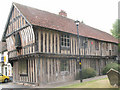
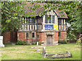
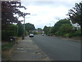
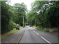
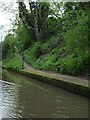
B38 8TJ is a compact residential cluster occupying just 1.8 hectares within the Kings Norton North Ward of Birmingham City Council. This small geographical footprint houses 1,369 residents, creating a density of 1,317 people per square kilometre. The location retains historical significance as part of the former Kings Norton and Northfield Urban District, which was absorbed into the greater city in 1911. Today, this postcode serves as a quiet suburban enclave located near the historic Worcester and Birmingham Canal. The area offers a mix of convenience and seclusion, positioned close to major transport links and local trading centres. Living in B38 8TJ means residing in a neighbourhood that balances historical character with modern suburban accessibility. While the ward was once a county-court borough known for wool and pottery trade, it now functions as a practical residential zone for families and professionals seeking space within the city limits. The high population density relative to its small size ensures that residents benefit from proximity to services without the sprawling isolation of more distant outposts. This specific postcode area represents a stable, established slice of the southern Birmingham suburbs where daily life moves at a measured pace.
- Area Type
- Postcode
- Area Size
- 1.8 hectares
- Population
- 1369
- Population Density
- 1317 people/km²
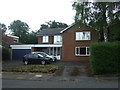
The property market in B38 8TJ is defined almost exclusively by owner-occupied housing. With a home ownership rate of 90%, the area functions as a settled residential zone rather than a rental hub. This statistic indicates that prospective buyers are looking to purchase existing homes rather than enter a short-term let market. The predominant accommodation type consists of houses, which aligns with the density constraints of a 1.8-hectare area near Kings Norton. This housing stock likely includes semi-detached and detached properties typical of the post-war and Victorian expansions within the former Kings Norton Urban District. For buyers seeking a family home, the high ownership percentage suggests a well-maintained street network and a community invested in property values. You are unlikely to encounter purpose-built flats or shared ownership deals within this specific postcode cluster. Instead, the market revolves around individual detached and semi-detached dwellings that have been passed down through generations. This structure supports a stable ecosystem where homeowners take pride in their dwellings and often remain in the same house for decades. The combination of house-based living and high ownership creates a predictable market for those wishing to buy into this established fabric of Birmingham suburbs.
House Prices in B38 8TJ
Showing 12 properties
| Address | Type | Beds | Baths | Last Sale Price | Last Sale Date | |
|---|---|---|---|---|---|---|
| 11 Kingsway Drive, Birmingham, B38 8TJ | Detached | 3 | 1 | £355,000 | Oct 2018 | |
| 1 Kingsway Drive, Birmingham, B38 8TJ | Detached | 3 | 2 | £270,000 | Apr 2016 | |
| 8 Kingsway Drive, Birmingham, B38 8TJ | house | - | - | £225,500 | Apr 2013 | |
| 10 Kingsway Drive, Birmingham, B38 8TJ | house | - | - | £234,500 | Jun 2010 | |
| 12 Kingsway Drive, Birmingham, B38 8TJ | Detached | 3 | 2 | £165,000 | Jul 2002 | |
| 6 Kingsway Drive, Birmingham, B38 8TJ | Detached | - | - | £195,000 | Jul 2002 | |
| 4 Kingsway Drive, Birmingham, B38 8TJ | Detached | 5 | - | £160,000 | Apr 2002 | |
| 3 Kingsway Drive, Birmingham, B38 8TJ | Detached | - | - | £93,500 | Aug 1999 | |
| 2 Kingsway Drive, Birmingham, B38 8TJ | Detached | 3 | - | £135,000 | Aug 1999 | |
| 9 Kingsway Drive, Birmingham, B38 8TJ | Detached | - | - | - | - |
Energy Efficiency in B38 8TJ
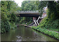
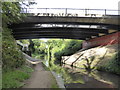
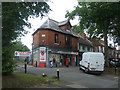
Residents of B38 8TJ enjoy convenient access to essential retail and transport nodes located just outside the postcode boundary. Within practical reach, you will find five notable retail outlets, including Co-op Kings, Co-op Cotteridge, and Heron Bournville, which cover daily shopping requirements. Transport convenience is equally high, with five nearby railway stations providing swift connections to Kings Norton, Bournville, and Northfield. Furthermore, the broader urban network connects you easily to the Edgbaston Village, Centenary Square, and Town Hall, allowing quick access to Birmingham's city centre. While the immediate 1.8-hectare area is quiet, the surrounding infrastructure ensures you do not need to commute far for groceries or transit. The Worcester and Birmingham Canal runs through the wider ward, offering a scenic route for walks or quiet contemplation near the northern edge of the postcode. This blend of local high street access and major city links makes living in B38 8TJ a practical choice for those who prefer a neighbourhood feel without sacrificing urban convenience.
Amenities
Schools
For families residing in B38 8TJ, educational provision nearby is supported by a single nursery facility. Kings Norton Nursery School operates on the edge of this postcode area, serving young children who require early years education before entering primary education. This facility is the only nearby school listed in the immediate vicinity, indicating that parents often look slightly further afield for primary and secondary institutions. The presence of a named nursery suggests a focus on early childhood development for the local population. While primary and secondary schools are not explicitly detailed for this specific postcode, the availability of Kings Norton Nursery School provides a clear starting point for early education within the Kings Norton Ward. You must plan carefully regarding travel times to larger comprehensive or academy schools in Birmingham, as the area is small and lacks multiple educational options on its own. The school situation reflects the residential nature of the postcode, where early years care is prioritised locally while older children typically travel to designated catchment areas in the wider Birmingham City Council zone.
| Rank | School | Type | Entry gender | Ages |
|---|
Explore more schools in this area
Go to Schools tabDemographics
The community within B38 8TJ demonstrates a mature demographic profile with a median age of 47 years. Most residents fall into the adult bracket ranging from 30 to 64 years old, indicating a neighbourhood dominated by working families rather than young singles or retirees. Home ownership stands at an impressive 90%, suggesting that the vast majority of households live in properties they secure through their own means. This high level of ownership typically points to long-term stability and deep-rooted local ties. The predominant ethnic group is White, which aligns with the traditional character of the Kings Norton and Northfield area. Accommodation types in this small cluster consist almost entirely of houses, reflecting the suburban planning history of the late 19th and early 20th centuries. You will not find high-rise flats or purpose-built rental estates dominating the streetscape here. The demographic stability, combined with the high ownership rate, creates an environment where neighbours often know one another by name. This community lacks the transient feel common in newer development zones, favouring established households who value quiet streets and consistent schooling options.
Household Size
Accommodation Type
Tenure
Ethnic Group
Religion
Household Composition
Age
Household Deprivation
NS-SEC
Explore more demographic insights in this area
Go to Demographics tabPlanning
Planning Constraints
- Flood RiskPremium
- Ramsar Wetland SitesPremium
- Area of Outstanding Natural BeautyPremium
- Protected Nature ReservePremium
- Protected WoodlandPremium