Area Overview for B38 8SA
Photos of B38 8SA
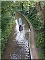
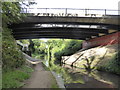
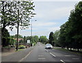
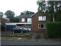
49 photos from this area
Area Information
Key information about the B38 8SA including its size, population, and administrative classification.
- Area Type
- Postcode
- Area Size
- 2.2 hectares
- Population
- 1369
- Population Density
- 1317 people/km²
House Prices in B38 8SA
24
Properties
£338,538
Average Sold Price
£135,000
Lowest Price
£540,000
Highest Price
Showing 24 properties
| Address | Type | Beds | Baths | Last Sale Price | Last Sale Date | |
|---|---|---|---|---|---|---|
| 20 Kingshill Drive, Birmingham, B38 8SA | Detached | 4 | 1 | £540,000 | Jun 2023 | |
| 4 Kingshill Drive, Birmingham, B38 8SA | Retail | 3 | 1 | £380,000 | Mar 2022 | |
| 24 Kingshill Drive, Birmingham, B38 8SA | Semi-detached | 3 | - | £399,950 | Mar 2022 | |
| 1 Kingshill Drive, Birmingham, B38 8SA | house | 3 | - | £360,000 | Sep 2021 | |
| 2 Kingshill Drive, Birmingham, B38 8SA | Semi-detached | 3 | 2 | £335,000 | Jan 2021 | |
| 7 Kingshill Drive, Birmingham, B38 8SA | Detached | 4 | 2 | £485,000 | Jun 2019 | |
| 3 Kingshill Drive, Birmingham, B38 8SA | Detached | 3 | 1 | £396,000 | Oct 2018 | |
| 5 Kingshill Drive, Birmingham, B38 8SA | Detached | 3 | - | £375,000 | Aug 2016 | |
| 15 Kingshill Drive, Birmingham, B38 8SA | Detached | - | - | £320,000 | Jul 2007 | |
| 8 Kingshill Drive, Birmingham, B38 8SA | Semi-detached | - | - | £198,500 | Dec 2003 |
Page 1 of 3
Energy Efficiency in B38 8SA
Amenities
Schools
| Rank | School | Type | Entry gender | Ages |
|---|
Explore more schools in this area
Go to Schools tabDemographics
Household Size
Two person
most common
Accommodation Type
Houses
most common
Tenure
90
majority
Ethnic Group
White
most common
Religion
N/A
most common
Household Composition
N/A
most common
Age
47
median
Adults (30-64 years)
most common
Household Deprivation
N/A
with no deprivation
NS-SEC
49
in Lower managerial occupations
Explore more demographic insights in this area
Go to Demographics tabPlanning
Planning Constraints
- Flood RiskPremium
- Ramsar Wetland SitesPremium
- Area of Outstanding Natural BeautyPremium
- Protected Nature ReservePremium
- Protected WoodlandPremium