Area Overview for B34 6JN
Photos of B34 6JN
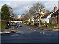
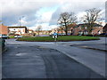
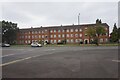
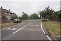
20 photos from this area
Area Information
Key information about the B34 6JN including its size, population, and administrative classification.
- Area Type
- Postcode
- Area Size
- 1.5 hectares
- Population
- 1593
- Population Density
- 5611 people/km²
House Prices in B34 6JN
58
Properties
£94,841
Average Sold Price
£50,000
Lowest Price
£252,000
Highest Price
Showing 58 properties
| Address | Type | Beds | Baths | Last Sale Price | Last Sale Date | |
|---|---|---|---|---|---|---|
| 151 Darley Avenue, Birmingham, B34 6JN | Terraced | 3 | 2 | £133,000 | Sep 2023 | |
| 98 Darley Avenue, Birmingham, B34 6JN | Maisonette | 1 | 1 | £85,000 | Apr 2023 | |
| 112 Darley Avenue, Birmingham, B34 6JN | Semi-detached | 3 | 2 | £252,000 | Jun 2022 | |
| 132 Darley Avenue, Birmingham, B34 6JN | Maisonette | 1 | 1 | £85,000 | May 2021 | |
| 114 Darley Avenue, Birmingham, B34 6JN | house | - | - | £84,000 | Apr 2021 | |
| 122 Darley Avenue, Birmingham, B34 6JN | Semi-detached | 4 | 2 | £70,000 | Apr 2021 | |
| 201 Darley Avenue, Birmingham, B34 6JN | Semi-detached | 3 | - | £104,500 | Jul 2020 | |
| 102 Darley Avenue, Birmingham, B34 6JN | Semi-detached | 2 | 1 | £102,000 | Sep 2019 | |
| 163 Darley Avenue, Birmingham, B34 6JN | Terraced | 3 | - | £125,000 | Jun 2019 | |
| 104 Darley Avenue, Birmingham, B34 6JN | Semi-detached | 2 | - | £80,000 | Sep 2017 |
Page 1 of 6
Energy Efficiency in B34 6JN
Amenities
Schools
| Rank | School | Type | Entry gender | Ages |
|---|
Explore more schools in this area
Go to Schools tabDemographics
Household Size
One person
most common
Accommodation Type
Houses
most common
Tenure
66
majority
Ethnic Group
White
most common
Religion
N/A
most common
Household Composition
N/A
most common
Age
47
median
Adults (30-64 years)
most common
Household Deprivation
N/A
with no deprivation
NS-SEC
20
in Lower managerial occupations
Explore more demographic insights in this area
Go to Demographics tabPlanning
Planning Constraints
- Flood RiskPremium
- Ramsar Wetland SitesPremium
- Area of Outstanding Natural BeautyPremium
- Protected Nature ReservePremium
- Protected WoodlandPremium