Area Overview for B34 6JL
Photos of B34 6JL
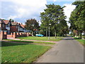
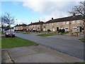
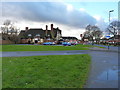
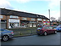
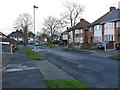
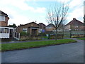
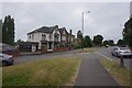
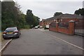
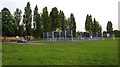
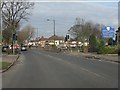
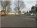
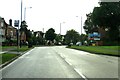
16 photos from this area
Area Information
Key information about the B34 6JL including its size, population, and administrative classification.
- Area Type
- Postcode
- Area Size
- 1.1 hectares
- Population
- 1593
- Population Density
- 5611 people/km²
House Prices in B34 6JL
35
Properties
£132,165
Average Sold Price
£63,000
Lowest Price
£228,000
Highest Price
Showing 35 properties
| Address | Type | Beds | Baths | Last Sale Price | Last Sale Date | |
|---|---|---|---|---|---|---|
| 35 Galloway Avenue, Birmingham, B34 6JL | house | - | - | £210,000 | Jul 2022 | |
| 33 Galloway Avenue, Birmingham, B34 6JL | Semi-detached | 2 | 1 | £228,000 | Nov 2021 | |
| 27 Galloway Avenue, Birmingham, B34 6JL | Semi-detached | 2 | 1 | £152,650 | Jan 2017 | |
| 41 Galloway Avenue, Birmingham, B34 6JL | Terraced | 2 | - | £67,500 | Jul 2016 | |
| 73 Galloway Avenue, Birmingham, B34 6JL | Semi-detached | - | - | £80,000 | May 2016 | |
| 23 Galloway Avenue, Birmingham, B34 6JL | Semi-detached | 3 | 1 | £166,000 | Oct 2014 | |
| 31 Galloway Avenue, Birmingham, B34 6JL | Semi-detached | 2 | 1 | £140,000 | Jun 2014 | |
| 15 Galloway Avenue, Birmingham, B34 6JL | Bungalow | - | - | £115,000 | Sep 2011 | |
| 5 Galloway Avenue, Birmingham, B34 6JL | house | - | - | £109,000 | Nov 2009 | |
| 45 Galloway Avenue, Birmingham, B34 6JL | Terraced | - | - | £83,000 | Oct 2008 |
Page 1 of 4
Energy Efficiency in B34 6JL
Amenities
Schools
| Rank | School | Type | Entry gender | Ages |
|---|
Explore more schools in this area
Go to Schools tabDemographics
Household Size
One person
most common
Accommodation Type
Houses
most common
Tenure
66
majority
Ethnic Group
White
most common
Religion
N/A
most common
Household Composition
N/A
most common
Age
47
median
Adults (30-64 years)
most common
Household Deprivation
N/A
with no deprivation
NS-SEC
20
in Lower managerial occupations
Explore more demographic insights in this area
Go to Demographics tabPlanning
Planning Constraints
- Flood RiskPremium
- Ramsar Wetland SitesPremium
- Area of Outstanding Natural BeautyPremium
- Protected Nature ReservePremium
- Protected WoodlandPremium