Area Overview for B34 6JH
Photos of B34 6JH
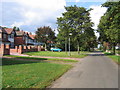
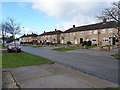
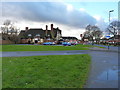
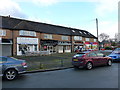
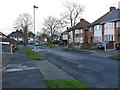
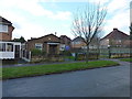
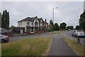
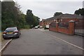
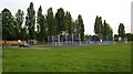
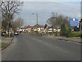
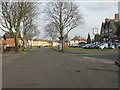
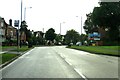
16 photos from this area
Area Information
Key information about the B34 6JH including its size, population, and administrative classification.
- Area Type
- Postcode
- Area Size
- 1.1 hectares
- Population
- 1593
- Population Density
- 5611 people/km²
House Prices in B34 6JH
36
Properties
£167,154
Average Sold Price
£84,000
Lowest Price
£260,000
Highest Price
Showing 36 properties
| Address | Type | Beds | Baths | Last Sale Price | Last Sale Date | |
|---|---|---|---|---|---|---|
| 40 Galloway Avenue, Birmingham, B34 6JH | Terraced | 2 | 2 | £200,000 | Dec 2025 | |
| 64 Galloway Avenue, Birmingham, B34 6JH | Terraced | 3 | - | £87,435 | Jul 2025 | |
| 18 Galloway Avenue, Birmingham, B34 6JH | house | 3 | 1 | £250,000 | May 2025 | |
| 36 Galloway Avenue, Birmingham, B34 6JH | Semi-detached | 3 | 1 | £260,000 | Jun 2024 | |
| 46 Galloway Avenue, Birmingham, B34 6JH | Terraced | 3 | 1 | £250,000 | Sep 2023 | |
| 48 Galloway Avenue, Birmingham, B34 6JH | Terraced | 3 | 1 | £140,000 | Oct 2019 | |
| 24 Galloway Avenue, Birmingham, B34 6JH | Semi-detached | 4 | 1 | £252,000 | Apr 2019 | |
| 62 Galloway Avenue, Birmingham, B34 6JH | Bungalow | 1 | 1 | £114,000 | Jan 2019 | |
| 6 Galloway Avenue, Birmingham, B34 6JH | Semi-detached | 3 | 1 | £224,000 | Sep 2018 | |
| 52 Galloway Avenue, Birmingham, B34 6JH | Terraced | 3 | 1 | £158,000 | Aug 2018 |
Page 1 of 4
Energy Efficiency in B34 6JH
Amenities
Schools
| Rank | School | Type | Entry gender | Ages |
|---|
Explore more schools in this area
Go to Schools tabDemographics
Household Size
One person
most common
Accommodation Type
Houses
most common
Tenure
66
majority
Ethnic Group
White
most common
Religion
N/A
most common
Household Composition
N/A
most common
Age
47
median
Adults (30-64 years)
most common
Household Deprivation
N/A
with no deprivation
NS-SEC
20
in Lower managerial occupations
Explore more demographic insights in this area
Go to Demographics tabPlanning
Planning Constraints
- Flood RiskPremium
- Ramsar Wetland SitesPremium
- Area of Outstanding Natural BeautyPremium
- Protected Nature ReservePremium
- Protected WoodlandPremium