Area Overview for B33 9JS
Photos of B33 9JS
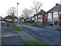
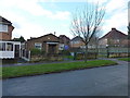
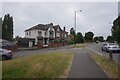
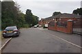
16 photos from this area
Area Information
Key information about the B33 9JS including its size, population, and administrative classification.
- Area Type
- Postcode
- Area Size
- 3046 m²
- Population
- 1762
- Population Density
- 8850 people/km²
House Prices in B33 9JS
9
Properties
£112,896
Average Sold Price
£55,950
Lowest Price
£192,000
Highest Price
Showing 9 properties
| Address | Type | Beds | Baths | Last Sale Price | Last Sale Date | |
|---|---|---|---|---|---|---|
| 57 Lyme Green Road, Birmingham, B33 9JS | Semi-detached | 2 | 1 | £192,000 | Feb 2024 | |
| 48 Lyme Green Road, Birmingham, B33 9JS | house | 2 | 1 | £145,000 | Mar 2021 | |
| 42 Lyme Green Road, Birmingham, B33 9JS | Semi-detached | 2 | 1 | £105,000 | Feb 2008 | |
| 44 Lyme Green Road, Birmingham, B33 9JS | Semi-detached | 2 | 1 | £99,425 | Dec 2005 | |
| 46 Lyme Green Road, Birmingham, B33 9JS | house | - | - | £80,000 | Nov 2003 | |
| 52 Lyme Green Road, Birmingham, B33 9JS | Semi-detached | - | - | £55,950 | May 2001 | |
| 55 Lyme Green Road, Birmingham, B33 9JS | house | - | - | - | - | |
| 50 Lyme Green Road, Birmingham, B33 9JS | house | - | - | - | - | |
| 59 Lyme Green Road, Birmingham, B33 9JS | Semi-detached | - | - | - | - |
Energy Efficiency in B33 9JS
Amenities
Schools
| Rank | School | Type | Entry gender | Ages |
|---|
Explore more schools in this area
Go to Schools tabDemographics
Household Size
Family (3-5 people)
most common
Accommodation Type
Houses
most common
Tenure
34
majority
Ethnic Group
White
most common
Religion
N/A
most common
Household Composition
N/A
most common
Age
47
median
Adults (30-64 years)
most common
Household Deprivation
N/A
with no deprivation
NS-SEC
14
in Lower managerial occupations
Explore more demographic insights in this area
Go to Demographics tabPlanning
Planning Constraints
- Flood RiskPremium
- Ramsar Wetland SitesPremium
- Area of Outstanding Natural BeautyPremium
- Protected Nature ReservePremium
- Protected WoodlandPremium