Area Overview for B32 1LU
Photos of B32 1LU
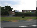
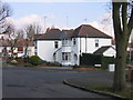
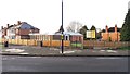
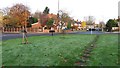
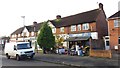
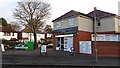
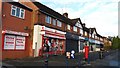
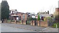
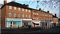
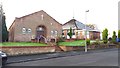
27 photos from this area
Area Information
Key information about the B32 1LU including its size, population, and administrative classification.
- Area Type
- Postcode
- Area Size
- 1.0 hectares
- Population
- 1624
- Population Density
- 6902 people/km²
House Prices in B32 1LU
29
Properties
£113,812
Average Sold Price
£41,000
Lowest Price
£220,000
Highest Price
Showing 29 properties
| Address | Type | Beds | Baths | Last Sale Price | Last Sale Date | |
|---|---|---|---|---|---|---|
| 71 Faraday Avenue, Birmingham, B32 1LU | Semi-detached | 3 | 1 | £140,000 | Mar 2025 | |
| 73 Faraday Avenue, Birmingham, B32 1LU | Semi-detached | 3 | 1 | £220,000 | Nov 2024 | |
| 27 Faraday Avenue, Birmingham, B32 1LU | house | - | - | £167,000 | Mar 2021 | |
| 31 Faraday Avenue, Birmingham, B32 1LU | Semi-detached | 3 | 1 | £172,000 | Jan 2021 | |
| 65 Faraday Avenue, Birmingham, B32 1LU | Semi-detached | 3 | 1 | £155,000 | Jun 2019 | |
| 51 Faraday Avenue, Birmingham, B32 1LU | Detached | 3 | 1 | £106,000 | Oct 2009 | |
| 55 Faraday Avenue, Birmingham, B32 1LU | house | - | - | £97,500 | Sep 2009 | |
| 39 Faraday Avenue, Birmingham, B32 1LU | Terraced | - | - | £113,000 | Jul 2008 | |
| 41 Faraday Avenue, Birmingham, B32 1LU | Semi-detached | - | - | £120,000 | Jan 2006 | |
| 25 Faraday Avenue, Birmingham, B32 1LU | Semi-detached | - | - | £120,000 | Jun 2005 |
Page 1 of 3
Energy Efficiency in B32 1LU
Amenities
Schools
| Rank | School | Type | Entry gender | Ages |
|---|
Explore more schools in this area
Go to Schools tabDemographics
Household Size
Family (3-5 people)
most common
Accommodation Type
Houses
most common
Tenure
53
majority
Ethnic Group
White
most common
Religion
N/A
most common
Household Composition
N/A
most common
Age
47
median
Adults (30-64 years)
most common
Household Deprivation
N/A
with no deprivation
NS-SEC
25
in Lower managerial occupations
Explore more demographic insights in this area
Go to Demographics tabPlanning
Planning Constraints
- Flood RiskPremium
- Ramsar Wetland SitesPremium
- Area of Outstanding Natural BeautyPremium
- Protected Nature ReservePremium
- Protected WoodlandPremium