Area Overview for B31 3JW
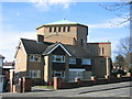
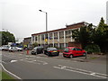
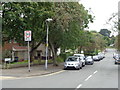
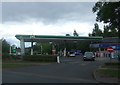
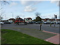
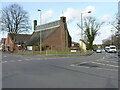
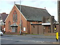
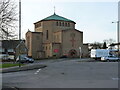
Photos of B31 3JW


Area Information
B31 3JW is a small, densely populated residential postcode area in south-west Birmingham, nestled within the broader West Heath suburb. With a population of 2,066 spread over just 1.5 hectares, the area reflects a compact, high-density living environment typical of post-war housing developments. Historically part of Kings Norton manorial lands, it sits on former heathland that has since transformed into a suburban dormitory for Birmingham’s commuters. The area is bordered by Kings Norton, Northfield, and Longbridge, with its character shaped by mid-20th-century housing estates built to accommodate returning servicemen and displaced families. Today, it serves as a practical base for those working in central Birmingham, with its proximity to rail links and local amenities. Despite its size, B31 3JW offers a mix of residential tranquillity and connectivity, though its small footprint means the community is tightly knit, with limited scope for expansion. The area’s compact nature ensures residents are within easy reach of shops, schools, and transport hubs, though its density also underscores the need for efficient planning and infrastructure.
- Area Type
- Postcode
- Area Size
- 1.5 hectares
- Population
- 2066
- Population Density
- 5590 people/km²
The property market in B31 3JW is characterised by a high proportion of owner-occupied homes, with 67% of residents living in their own properties. The accommodation type is primarily houses, which is unusual for a densely populated area but aligns with the post-war housing developments that shaped West Heath. This suggests a focus on family homes rather than flats or apartments, though the limited area size means housing stock is constrained. For buyers, this means the market is likely competitive, with limited availability of new properties. The area’s proximity to Birmingham’s core and transport links may make it attractive for commuters, but its small footprint means opportunities for expansion are minimal. Prospective buyers should consider the high population density and the predominance of owner-occupied housing when assessing long-term value or investment potential.
House Prices in B31 3JW
Showing 22 properties
| Address | Type | Beds | Baths | Last Sale Price | Last Sale Date | |
|---|---|---|---|---|---|---|
| 63 Alvechurch Road, Birmingham, B31 3JW | Terraced | 2 | 2 | £146,000 | Apr 2020 | |
| 7A Alvechurch Road, Birmingham, B31 3JW | Flat | - | - | £80,000 | Jul 2019 | |
| 9A Alvechurch Road, Birmingham, B31 3JW | Flat | - | - | £82,000 | Jun 2007 | |
| 49 Alvechurch Road, Birmingham, B31 3JW | Terraced | 2 | 1 | £91,000 | Apr 2007 | |
| 59 Alvechurch Road, Birmingham, B31 3JW | house | - | - | £67,000 | Jan 2000 | |
| 43 Alvechurch Road, Birmingham, B31 3JW | Restaurant | - | - | - | - | |
| 65 Alvechurch Road, Birmingham, B31 3JW | Terraced | 4 | 1 | - | - | |
| 27A Alvechurch Road, Birmingham, B31 3JW | Flat | 3 | 1 | - | - | |
| Flat Over, 51 Alvechurch Road, Birmingham, B31 3JW | Flat | - | - | - | - | |
| 39 Alvechurch Road, Birmingham, B31 3JW | undefined | - | - | - | - |
Energy Efficiency in B31 3JW
Residents of B31 3JW have access to a range of amenities within walking or short driving distance. Retail options include Tesco West, Morrisons Daily, and other local shops, ensuring everyday needs are met. The area’s rail links to Northfield, Longbridge, and Kings Norton provide easy access to Birmingham’s broader transport network, while nearby metro stops like Edgbaston Village and Centenary Square connect to the city’s central districts. Green spaces such as West Heath Park and Cofton Park offer recreational opportunities, complemented by community facilities like the West Heath Community Centre and local schools including Cofton Primary and St. John Fisher Roman Catholic Primary. The presence of pubs like The Man On The Moon and historic sites like Longbridge House adds to the area’s character. This mix of retail, transport, and leisure options supports a convenient, well-connected lifestyle, though the compact nature of the area means amenities are concentrated rather than sprawling.
Amenities
Schools
| Rank | School | Type | Entry gender | Ages |
|---|
Explore more schools in this area
Go to Schools tabDemographics
The population of B31 3JW is 2,066, with a median age of 47 and a majority of residents aged 30–64. This suggests a mature, stable community with a strong presence of working-age adults. Home ownership stands at 67%, indicating a significant proportion of residents live in their own homes rather than renting. The accommodation type is predominantly houses, reflecting a residential area with more traditional housing stock. The predominant ethnic group is White, though the data does not specify further diversity metrics. The area’s population density of 138,706 people per square kilometre is exceptionally high, which may influence the character of daily life, fostering close-knit interactions but also potential strain on local services. This density, combined with the median age, suggests a community that is largely established, with fewer young families or retirees compared to other parts of Birmingham.
Household Size
Accommodation Type
Tenure
Ethnic Group
Religion
Household Composition
Age
Household Deprivation
NS-SEC
Explore more demographic insights in this area
Go to Demographics tabPlanning
Planning Constraints
- Flood RiskPremium
- Ramsar Wetland SitesPremium
- Area of Outstanding Natural BeautyPremium
- Protected Nature ReservePremium
- Protected WoodlandPremium