Area Overview for B31 3JS
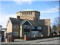
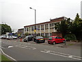
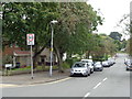
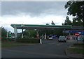
Photos of B31 3JS


Area Information
Living in B31 3JS means inhabiting a compact, residential postcode in south-west Birmingham, where the landscape has shifted from heathland to suburban housing. The area covers 7,535 square metres and is home to 1,774 people, making it a densely populated but small cluster of homes. Its history dates to the early 1900s, with post-war development shaping its character as a dormitory suburb for Birmingham. The median age of 47 suggests a community of established residents, many of whom are adults aged 30–64. This area is not a standalone town but part of the broader West Heath ward, which includes nearby villages and parks. Daily life here is defined by proximity to rail links, local shops, and green spaces, with a focus on practical living rather than urban vibrancy. The compact size means amenities are within walking or short driving distance, though the area’s small footprint also means it is not suited to those seeking sprawling estates or extensive commercial hubs. For those prioritising convenience and a settled community, B31 3JS offers a quiet, well-connected slice of Birmingham’s suburban fabric.
- Area Type
- Postcode
- Area Size
- 7535 m²
- Population
- 1774
- Population Density
- 5326 people/km²
The property market in B31 3JS is defined by its 48% home ownership rate and a focus on houses rather than flats or apartments. This suggests a predominantly owner-occupied area, though the relatively low home ownership rate implies a significant rental market. The presence of houses indicates a mix of family homes and larger properties, typical of suburban settings. However, the area’s small size—just 7,535 square metres—means the housing stock is limited, and buyers should consider the potential scarcity of properties in this specific postcode. The immediate surroundings, including parts of West Heath and nearby villages, may offer more options for those seeking larger estates or alternative property types. For buyers, the challenge lies in the area’s compact footprint: while it is well-connected to Birmingham’s transport networks, the limited space means competition for available homes could be fierce, particularly for those prioritising proximity to rail links and local amenities.
House Prices in B31 3JS
Showing 36 properties
| Address | Type | Beds | Baths | Last Sale Price | Last Sale Date | |
|---|---|---|---|---|---|---|
| 83 Redhill Road, Northfield, Birmingham, B31 3JS | Terraced | 2 | - | £120,000 | Sep 2025 | |
| 55 Redhill Road, Northfield, Birmingham, B31 3JS | Terraced | 3 | 1 | £205,000 | Jul 2023 | |
| 69 Redhill Road, Northfield, Birmingham, B31 3JS | Terraced | 3 | 1 | £170,000 | Aug 2022 | |
| 65 Redhill Road, Northfield, Birmingham, B31 3JS | Terraced | 2 | 1 | £162,750 | Aug 2022 | |
| 85 Redhill Road, Northfield, Birmingham, B31 3JS | Terraced | 2 | 1 | £190,000 | May 2022 | |
| 59 Redhill Road, Northfield, Birmingham, B31 3JS | Terraced | 3 | 2 | £166,000 | Nov 2021 | |
| 63 Redhill Road, Northfield, Birmingham, B31 3JS | Terraced | 3 | 1 | £123,900 | Jul 2018 | |
| 43A Redhill Road, Northfield, Birmingham, B31 3JS | Terraced | 3 | 1 | £60,000 | Aug 2017 | |
| 75 Redhill Road, Northfield, Birmingham, B31 3JS | Flat | 1 | 1 | £98,000 | Apr 2014 | |
| 71 Redhill Road, Northfield, Birmingham, B31 3JS | house | 2 | 1 | £92,000 | Jun 2012 |
Energy Efficiency in B31 3JS
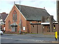
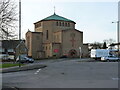
Residents of B31 3JS have access to a range of amenities within practical reach, including retail options such as Tesco West and Morrisons Daily, which cater to everyday needs. The area’s rail links to Northfield, Longbridge, and Kings Norton provide easy access to Birmingham’s wider transport network, while nearby metro stops like Edgbaston Village and Centenary Square connect to the city’s cultural and commercial hubs. Locally, West Heath Park and Cofton Park offer green spaces for recreation, and landmarks such as St. Anne’s Church and The Man On The Moon pub contribute to the area’s character. Schools like Cofton Primary, West Heath Primary, and St. John Fisher Roman Catholic Primary are within walking distance, making it suitable for families. The presence of community centres, such as West Heath Community Centre, and historic sites like Longbridge House, which was once a Civil War headquarters, adds to the area’s distinct identity. This blend of practicality and local charm supports a lifestyle that balances suburban comfort with urban connectivity.
Amenities
Schools
| Rank | School | Type | Entry gender | Ages |
|---|
Explore more schools in this area
Go to Schools tabDemographics
The population of B31 3JS is 1,774, with a population density of 235,445 people per square kilometre, reflecting its small size and high concentration of residents. The median age of 47 indicates a mature demographic, with the most common age range being adults aged 30–64. This suggests a community of long-term residents rather than a transient population. Home ownership stands at 48%, meaning nearly half of properties are owner-occupied, while the remaining 52% are likely rented. The predominant accommodation type is houses, which aligns with the area’s suburban character. The predominant ethnic group is White, though no specific data on diversity or deprivation is provided. The high population density, combined with the age profile, points to a stable, low-turnover community. However, the lack of detailed socioeconomic data means it is difficult to assess whether this density correlates with higher deprivation or simply reflects the area’s compact nature.
Household Size
Accommodation Type
Tenure
Ethnic Group
Religion
Household Composition
Age
Household Deprivation
NS-SEC
Explore more demographic insights in this area
Go to Demographics tabPlanning
Planning Constraints
- Flood RiskPremium
- Ramsar Wetland SitesPremium
- Area of Outstanding Natural BeautyPremium
- Protected Nature ReservePremium
- Protected WoodlandPremium