Area Overview for B31 3JT
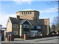
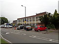
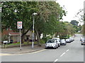
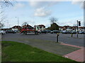
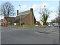
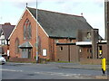
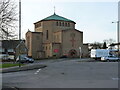
Photos of B31 3JT


Area Information
Living in B31 3JT means being part of a compact, residential cluster in south-west Birmingham, nestled between Kings Norton, Northfield, and Longbridge. The area covers 1.7 hectares and is home to 2,066 people, making it one of the city’s denser postcode areas. With a population density of 120,804 people per square kilometre, it is a tightly knit community where most homes are owner-occupied. Historically, B31 3JT evolved from open heathland into a post-war suburb, shaped by 1940s prefabs and 1960s permanent housing. Today, it serves as a dormitory area for Birmingham commuters, with a median age of 47 and a majority of residents aged 30–64. The area’s proximity to Longbridge, West Heath, and Cofton Hackett offers a blend of suburban tranquillity and easy access to Birmingham’s urban core. Its small size means amenities and services are closely clustered, with rail links and retail hubs within practical reach. For those seeking a quiet, established residential setting with strong connectivity, B31 3JT provides a balance of historical character and modern convenience.
- Area Type
- Postcode
- Area Size
- 1.7 hectares
- Population
- 2066
- Population Density
- 5590 people/km²
The property market in B31 3JT is dominated by owner-occupied homes, with 67% of residents living in properties they own. This contrasts with areas where rental demand drives the market, suggesting a focus on long-term residency and family homes. The area’s housing stock is primarily composed of houses rather than flats, reflecting its suburban character. Given the small area size of 1.7 hectares and a population of 2,066, the housing density is high, meaning properties are closely spaced. This compactness can make the market competitive, particularly for buyers seeking larger homes or land. The lack of major planning constraints—such as AONB or protected woodland—means development is unlikely to be restricted, though the area’s established nature may limit new housing supply. For buyers, this suggests a stable market with established homes, but potential challenges in finding larger properties or investment opportunities.
House Prices in B31 3JT
Showing 23 properties
| Address | Type | Beds | Baths | Last Sale Price | Last Sale Date | |
|---|---|---|---|---|---|---|
| 38 Lilley Lane, Birmingham, B31 3JT | Semi-detached | 2 | 1 | £190,000 | May 2024 | |
| 8 Lilley Lane, Birmingham, B31 3JT | Terraced | 2 | 1 | £335,000 | Jul 2022 | |
| 12 Lilley Lane, Birmingham, B31 3JT | house | - | - | £174,000 | Jan 2022 | |
| 42 Lilley Lane, Birmingham, B31 3JT | Terraced | 3 | 1 | £136,000 | Jan 2022 | |
| 52 Lilley Lane, Birmingham, B31 3JT | Terraced | 2 | 1 | £164,000 | Feb 2021 | |
| 36 Lilley Lane, Birmingham, B31 3JT | Semi-detached | 2 | 1 | £171,500 | Dec 2020 | |
| 30 Lilley Lane, Birmingham, B31 3JT | Semi-detached | 3 | - | £207,000 | Jul 2020 | |
| 32 Lilley Lane, Birmingham, B31 3JT | Terraced | 2 | - | £160,000 | Jul 2019 | |
| 22 Lilley Lane, Birmingham, B31 3JT | house | - | - | £140,000 | Mar 2012 | |
| 48 Lilley Lane, Birmingham, B31 3JT | Detached | 2 | 1 | £114,500 | Aug 2007 |
Energy Efficiency in B31 3JT
Daily life in B31 3JT is shaped by its proximity to retail, transport, and green spaces. Within practical reach are five retail outlets, including Tesco West and Morrisons Daily, offering essential shopping. Three metro stops—Edgbaston Village, Centenary Square, and Town Hall—provide links to Birmingham’s cultural and commercial districts. Nearby parks such as West Heath Park and Cofton Park offer recreational space, while schools like Cofton Primary and St. John Fisher Roman Catholic Primary cater to local families. The area also includes community hubs like West Heath Community Centre and historic sites such as St. Anne’s Church. The presence of pubs like The Man On The Moon and industrial areas like the Lightning Way estate adds to the area’s character. This mix of amenities ensures a convenient, self-contained lifestyle, with easy access to both suburban tranquillity and urban opportunities.
Amenities
Schools
| Rank | School | Type | Entry gender | Ages |
|---|
Explore more schools in this area
Go to Schools tabDemographics
The community in B31 3JT is predominantly composed of adults aged 30–64, with a median age of 47. This suggests a mature, settled population, likely with long-term ties to the area. Home ownership is high at 67%, indicating a stable housing market and a focus on family homes. The area is characterised by a majority of houses rather than flats, reflecting its suburban nature. The predominant ethnic group is White, which aligns with broader trends in Birmingham’s outer suburbs. While the data does not specify deprivation levels, the high home ownership and age profile suggest a relatively affluent, low-turnover community. The absence of detailed diversity metrics means the demographic composition remains largely homogenous. For residents, this translates to a stable, familiar environment with limited turnover, which can be both a strength and a consideration for those seeking more dynamic social or cultural diversity.
Household Size
Accommodation Type
Tenure
Ethnic Group
Religion
Household Composition
Age
Household Deprivation
NS-SEC
Explore more demographic insights in this area
Go to Demographics tabPlanning
Planning Constraints
- Flood RiskPremium
- Ramsar Wetland SitesPremium
- Area of Outstanding Natural BeautyPremium
- Protected Nature ReservePremium
- Protected WoodlandPremium