Area Overview for B29 7BA
Photos of B29 7BA


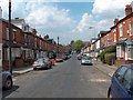
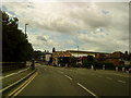

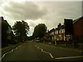
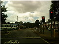
100 photos from this area
Area Information
Key information about the B29 7BA including its size, population, and administrative classification.
- Area Type
- Postcode
- Area Size
- 8409 m²
- Population
- 2405
- Population Density
- 8871 people/km²
House Prices in B29 7BA
41
Properties
£235,963
Average Sold Price
£42,000
Lowest Price
£600,000
Highest Price
Showing 41 properties
| Address | Type | Beds | Baths | Last Sale Price | Last Sale Date | |
|---|---|---|---|---|---|---|
| 27 Teignmouth Road, Birmingham, B29 7BA | Detached | 6 | 2 | £401,000 | Mar 2025 | |
| 5 Teignmouth Road, Birmingham, B29 7BA | Terraced | 6 | 6 | £375,000 | Oct 2024 | |
| 11 Teignmouth Road, Birmingham, B29 7BA | Terraced | 5 | 2 | £260,000 | Oct 2024 | |
| 69 Teignmouth Road, Birmingham, B29 7BA | Detached | 6 | 6 | £360,000 | Jan 2024 | |
| 23 Teignmouth Road, Birmingham, B29 7BA | Terraced | 4 | 1 | £230,000 | Nov 2023 | |
| 57 Teignmouth Road, Birmingham, B29 7BA | Detached | 6 | 2 | £485,000 | Feb 2023 | |
| 61 Teignmouth Road, Birmingham, B29 7BA | Detached | 7 | 7 | £600,000 | Dec 2022 | |
| 21 Teignmouth Road, Birmingham, B29 7BA | Detached | 6 | 6 | £350,000 | Jun 2021 | |
| 77 Teignmouth Road, Birmingham, B29 7BA | house | 5 | 3 | £360,000 | Oct 2020 | |
| 67 Teignmouth Road, Birmingham, B29 7BA | house | 3 | - | £275,000 | Aug 2019 |
Page 1 of 5
Energy Efficiency in B29 7BA
Amenities
Schools
| Rank | School | Type | Entry gender | Ages |
|---|
Explore more schools in this area
Go to Schools tabDemographics
Household Size
Family (3-5 people)
most common
Accommodation Type
Houses
most common
Tenure
15
majority
Ethnic Group
White
most common
Religion
N/A
most common
Household Composition
N/A
most common
Age
22
median
Young Adults (15-29 years)
most common
Household Deprivation
N/A
with no deprivation
NS-SEC
5
in Lower managerial occupations
Explore more demographic insights in this area
Go to Demographics tabPlanning
Planning Constraints
- Flood RiskPremium
- Ramsar Wetland SitesPremium
- Area of Outstanding Natural BeautyPremium
- Protected Nature ReservePremium
- Protected WoodlandPremium