Area Overview for B29 7DD
Photos of B29 7DD
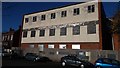
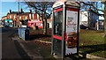
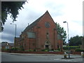
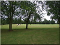
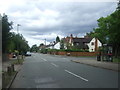
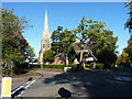
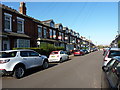
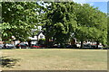
45 photos from this area
Area Information
Key information about the B29 7DD including its size, population, and administrative classification.
- Area Type
- Postcode
- Area Size
- 1.3 hectares
- Population
- 2405
- Population Density
- 8871 people/km²
House Prices in B29 7DD
35
Properties
£211,348
Average Sold Price
£60,000
Lowest Price
£495,000
Highest Price
Showing 35 properties
| Address | Type | Beds | Baths | Last Sale Price | Last Sale Date | |
|---|---|---|---|---|---|---|
| 186 Bournbrook Road, Birmingham, B29 7DD | Terraced | 2 | 1 | £277,000 | Jul 2025 | |
| 162 Bournbrook Road, Birmingham, B29 7DD | Terraced | 5 | 3 | £390,000 | May 2024 | |
| 176 Bournbrook Road, Birmingham, B29 7DD | Flat | 7 | 1 | £495,000 | Dec 2022 | |
| 164 Bournbrook Road, Birmingham, B29 7DD | Terraced | 9 | 9 | £340,000 | Aug 2019 | |
| 168 Bournbrook Road, Birmingham, B29 7DD | Terraced | 8 | 8 | £415,000 | Mar 2019 | |
| 144 Bournbrook Road, Birmingham, B29 7DD | Detached | 8 | 7 | £290,000 | Mar 2016 | |
| 180 Bournbrook Road, Birmingham, B29 7DD | Terraced | 5 | 2 | £220,000 | Jul 2014 | |
| 146 Bournbrook Road, Birmingham, B29 7DD | Detached | 8 | 7 | £228,000 | Aug 2008 | |
| 170 Bournbrook Road, Birmingham, B29 7DD | Terraced | 7 | 3 | £320,000 | May 2007 | |
| 160 Bournbrook Road, Birmingham, B29 7DD | Terraced | 5 | 2 | £180,000 | Apr 2005 |
Page 1 of 4
Energy Efficiency in B29 7DD
Amenities
Schools
| Rank | School | Type | Entry gender | Ages |
|---|
Explore more schools in this area
Go to Schools tabDemographics
Household Size
Family (3-5 people)
most common
Accommodation Type
Houses
most common
Tenure
15
majority
Ethnic Group
White
most common
Religion
N/A
most common
Household Composition
N/A
most common
Age
22
median
Young Adults (15-29 years)
most common
Household Deprivation
N/A
with no deprivation
NS-SEC
5
in Lower managerial occupations
Explore more demographic insights in this area
Go to Demographics tabPlanning
Planning Constraints
- Flood RiskPremium
- Ramsar Wetland SitesPremium
- Area of Outstanding Natural BeautyPremium
- Protected Nature ReservePremium
- Protected WoodlandPremium