Area Overview for B29 7DL
Photos of B29 7DL
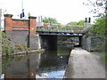
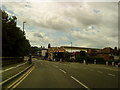
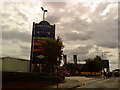
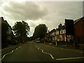
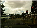
100 photos from this area
Area Information
Key information about the B29 7DL including its size, population, and administrative classification.
- Area Type
- Postcode
- Area Size
- 1.4 hectares
- Population
- 2100
- Population Density
- 23464 people/km²
House Prices in B29 7DL
70
Properties
£215,813
Average Sold Price
£38,000
Lowest Price
£420,000
Highest Price
Showing 70 properties
| Address | Type | Beds | Baths | Last Sale Price | Last Sale Date | |
|---|---|---|---|---|---|---|
| 57 Selly Hill Road, Birmingham, B29 7DL | Terraced | 5 | 5 | £336,000 | Feb 2024 | |
| 47 Selly Hill Road, Birmingham, B29 7DL | Terraced | 4 | 1 | £350,000 | Dec 2023 | |
| 61 Selly Hill Road, Birmingham, B29 7DL | Terraced | 5 | 2 | £420,000 | Oct 2023 | |
| 63 Selly Hill Road, Birmingham, B29 7DL | Terraced | 5 | 2 | £336,000 | May 2022 | |
| 59 Selly Hill Road, Birmingham, B29 7DL | house | 6 | 6 | £360,000 | Apr 2022 | |
| 37 Selly Hill Road, Birmingham, B29 7DL | Terraced | 7 | 6 | £380,000 | Jan 2022 | |
| 51 Selly Hill Road, Birmingham, B29 7DL | Terraced | 3 | 1 | £320,000 | Sep 2021 | |
| 67 Selly Hill Road, Birmingham, B29 7DL | Terraced | 4 | 6 | £330,000 | Aug 2021 | |
| 15 Selly Hill Road, Birmingham, B29 7DL | Terraced | 6 | 3 | £365,000 | Dec 2019 | |
| 41 Selly Hill Road, Birmingham, B29 7DL | house | 8 | 8 | £331,000 | Oct 2018 |
Page 1 of 7
Energy Efficiency in B29 7DL
Amenities
Schools
| Rank | School | Type | Entry gender | Ages |
|---|
Explore more schools in this area
Go to Schools tabDemographics
Household Size
Large (6+ people)
most common
Accommodation Type
Houses
most common
Tenure
6
majority
Ethnic Group
White
most common
Religion
N/A
most common
Household Composition
N/A
most common
Age
22
median
Young Adults (15-29 years)
most common
Household Deprivation
N/A
with no deprivation
NS-SEC
3
in Lower managerial occupations
Explore more demographic insights in this area
Go to Demographics tabPlanning
Planning Constraints
- Flood RiskPremium
- Ramsar Wetland SitesPremium
- Area of Outstanding Natural BeautyPremium
- Protected Nature ReservePremium
- Protected WoodlandPremium