Area Overview for B29 7AE
Photos of B29 7AE

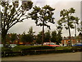
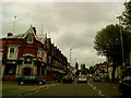
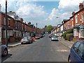
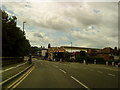

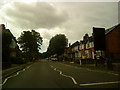
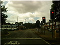
100 photos from this area
Area Information
Key information about the B29 7AE including its size, population, and administrative classification.
- Area Type
- Postcode
- Area Size
- 1.0 hectares
- Population
- 2182
- Population Density
- 17195 people/km²
House Prices in B29 7AE
67
Properties
£188,130
Average Sold Price
£69,950
Lowest Price
£375,000
Highest Price
Showing 67 properties
| Address | Type | Beds | Baths | Last Sale Price | Last Sale Date | |
|---|---|---|---|---|---|---|
| 14 Dawlish Road, Birmingham, B29 7AE | Terraced | 5 | 1 | £375,000 | Jul 2024 | |
| 20 Dawlish Road, Birmingham, B29 7AE | Terraced | 1 | 1 | £350,000 | Dec 2023 | |
| 50 Dawlish Road, Birmingham, B29 7AE | house | - | - | £160,000 | May 2023 | |
| 52 Dawlish Road, Birmingham, B29 7AE | Terraced | 4 | 1 | £105,000 | Mar 2023 | |
| 26 Dawlish Road, Birmingham, B29 7AE | house | 4 | 1 | £190,000 | Mar 2021 | |
| 18 Dawlish Road, Birmingham, B29 7AE | Detached | 6 | 6 | £350,000 | Oct 2019 | |
| 34 Dawlish Road, Birmingham, B29 7AE | Terraced | 7 | 7 | £262,000 | Mar 2016 | |
| 56 Dawlish Road, Birmingham, B29 7AE | house | 6 | 3 | £164,000 | Dec 2011 | |
| 24 Dawlish Road, Birmingham, B29 7AE | house | 4 | 1 | £150,000 | Jan 2006 | |
| 44 Dawlish Road, Birmingham, B29 7AE | Detached | 4 | 2 | £139,500 | Sep 2004 |
Page 1 of 7
Energy Efficiency in B29 7AE
Amenities
Schools
| Rank | School | Type | Entry gender | Ages |
|---|
Explore more schools in this area
Go to Schools tabDemographics
Household Size
Family (3-5 people)
most common
Accommodation Type
Houses
most common
Tenure
10
majority
Ethnic Group
White
most common
Religion
N/A
most common
Household Composition
N/A
most common
Age
22
median
Young Adults (15-29 years)
most common
Household Deprivation
N/A
with no deprivation
NS-SEC
5
in Lower managerial occupations
Explore more demographic insights in this area
Go to Demographics tabPlanning
Planning Constraints
- Flood RiskPremium
- Ramsar Wetland SitesPremium
- Area of Outstanding Natural BeautyPremium
- Protected Nature ReservePremium
- Protected WoodlandPremium