Area Overview for B29 7AF
Photos of B29 7AF

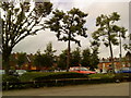
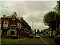
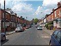
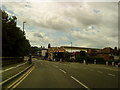

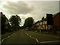
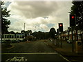
100 photos from this area
Area Information
Key information about the B29 7AF including its size, population, and administrative classification.
- Area Type
- Postcode
- Area Size
- 9765 m²
- Population
- 2182
- Population Density
- 17195 people/km²
House Prices in B29 7AF
55
Properties
£210,255
Average Sold Price
£40,000
Lowest Price
£600,000
Highest Price
Showing 55 properties
| Address | Type | Beds | Baths | Last Sale Price | Last Sale Date | |
|---|---|---|---|---|---|---|
| 77 Dawlish Road, Birmingham, B29 7AF | Terraced | 5 | 2 | £392,500 | May 2025 | |
| 75 Dawlish Road, Birmingham, B29 7AF | house | 4 | 1 | £380,000 | Oct 2024 | |
| 23 Dawlish Road, Birmingham, B29 7AF | house | 5 | 3 | £217,500 | Oct 2024 | |
| 83 Dawlish Road, Birmingham, B29 7AF | Terraced | 4 | 1 | £380,000 | Oct 2024 | |
| 101 Dawlish Road, Birmingham, B29 7AF | house | 6 | 6 | £600,000 | May 2024 | |
| 99 Dawlish Road, Birmingham, B29 7AF | Terraced | 6 | 6 | £187,500 | Oct 2023 | |
| 81 Dawlish Road, Birmingham, B29 7AF | house | 4 | - | £345,000 | Oct 2021 | |
| 11 Dawlish Road, Birmingham, B29 7AF | house | - | - | £357,000 | Aug 2021 | |
| 85 Dawlish Road, Birmingham, B29 7AF | Terraced | 3 | 1 | £306,000 | Sep 2018 | |
| 91 Dawlish Road, Birmingham, B29 7AF | Terraced | 4 | 1 | £302,000 | Apr 2017 |
Page 1 of 6
Energy Efficiency in B29 7AF
Amenities
Schools
| Rank | School | Type | Entry gender | Ages |
|---|
Explore more schools in this area
Go to Schools tabDemographics
Household Size
Family (3-5 people)
most common
Accommodation Type
Houses
most common
Tenure
10
majority
Ethnic Group
White
most common
Religion
N/A
most common
Household Composition
N/A
most common
Age
22
median
Young Adults (15-29 years)
most common
Household Deprivation
N/A
with no deprivation
NS-SEC
5
in Lower managerial occupations
Explore more demographic insights in this area
Go to Demographics tabPlanning
Planning Constraints
- Flood RiskPremium
- Ramsar Wetland SitesPremium
- Area of Outstanding Natural BeautyPremium
- Protected Nature ReservePremium
- Protected WoodlandPremium