Area Overview for B29 6BP
Photos of B29 6BP

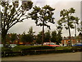
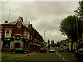
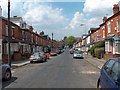
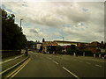
100 photos from this area
Area Information
Key information about the B29 6BP including its size, population, and administrative classification.
- Area Type
- Postcode
- Area Size
- 9493 m²
- Population
- 2523
- Population Density
- 17743 people/km²
House Prices in B29 6BP
49
Properties
£203,688
Average Sold Price
£40,000
Lowest Price
£565,000
Highest Price
Showing 49 properties
| Address | Type | Beds | Baths | Last Sale Price | Last Sale Date | |
|---|---|---|---|---|---|---|
| 34 Tiverton Road, Birmingham, B29 6BP | house | - | - | £565,000 | Dec 2023 | |
| 86 Tiverton Road, Birmingham, B29 6BP | Terraced | 4 | 1 | £372,000 | Jan 2022 | |
| 16 Tiverton Road, Birmingham, B29 6BP | Terraced | 4 | 2 | £375,000 | Jun 2021 | |
| 44 Tiverton Road, Birmingham, B29 6BP | Terraced | 4 | 2 | £402,000 | Apr 2021 | |
| 24 Tiverton Road, Birmingham, B29 6BP | Terraced | 4 | 1 | £325,000 | Jan 2021 | |
| 76 Tiverton Road, Birmingham, B29 6BP | Terraced | 6 | 3 | £325,000 | Jan 2018 | |
| 68 Tiverton Road, Birmingham, B29 6BP | Terraced | 7 | 7 | £155,000 | Jan 2017 | |
| 74 Tiverton Road, Birmingham, B29 6BP | house | 4 | - | £276,000 | Mar 2016 | |
| 94 Tiverton Road, Birmingham, B29 6BP | Terraced | 4 | 2 | £357,000 | Mar 2016 | |
| 36 Tiverton Road, Birmingham, B29 6BP | house | 4 | - | £320,000 | Nov 2015 |
Page 1 of 5
Energy Efficiency in B29 6BP
Amenities
Schools
| Rank | School | Type | Entry gender | Ages |
|---|
Explore more schools in this area
Go to Schools tabDemographics
Household Size
Family (3-5 people)
most common
Accommodation Type
Houses
most common
Tenure
11
majority
Ethnic Group
White
most common
Religion
N/A
most common
Household Composition
N/A
most common
Age
22
median
Young Adults (15-29 years)
most common
Household Deprivation
N/A
with no deprivation
NS-SEC
4
in Lower managerial occupations
Explore more demographic insights in this area
Go to Demographics tabPlanning
Planning Constraints
- Flood RiskPremium
- Ramsar Wetland SitesPremium
- Area of Outstanding Natural BeautyPremium
- Protected Nature ReservePremium
- Protected WoodlandPremium