Area Overview for B29 6TG
Photos of B29 6TG
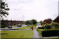
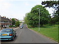
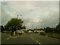
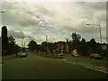
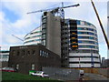


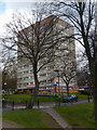
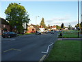
50 photos from this area
Area Information
Key information about the B29 6TG including its size, population, and administrative classification.
- Area Type
- Postcode
- Area Size
- 6840 m²
- Population
- 1535
- Population Density
- 5103 people/km²
House Prices in B29 6TG
11
Properties
£218,304
Average Sold Price
£70,000
Lowest Price
£430,000
Highest Price
Showing 11 properties
| Address | Type | Beds | Baths | Last Sale Price | Last Sale Date | |
|---|---|---|---|---|---|---|
| 227 Harborne Lane, Selly Oak, Birmingham, B29 6TG | Detached | 5 | 3 | £430,000 | Nov 2022 | |
| 231 Harborne Lane, Selly Oak, Birmingham, B29 6TG | Terraced | 5 | 4 | £428,000 | Jul 2021 | |
| 221 Harborne Lane, Selly Oak, Birmingham, B29 6TG | Terraced | 5 | 3 | £185,000 | Mar 2016 | |
| 225 Harborne Lane, Selly Oak, Birmingham, B29 6TG | house | 4 | - | £163,000 | Oct 2014 | |
| 233 Harborne Lane, Selly Oak, Birmingham, B29 6TG | Terraced | 5 | 2 | £175,000 | Mar 2014 | |
| 229 Harborne Lane, Selly Oak, Birmingham, B29 6TG | Detached | 5 | 5 | £77,125 | Jan 2002 | |
| 239 Harborne Lane, Selly Oak, Birmingham, B29 6TG | house | 4 | 1 | £70,000 | Apr 1999 | |
| Harborne Lane Specialist Centre, 247 Harborne Lane, Selly Oak, Birmingham, B29 6TG | Retirement | - | - | - | - | |
| 223 Harborne Lane, Selly Oak, Birmingham, B29 6TG | house | 6 | 3 | - | - | |
| 235 Harborne Lane, Selly Oak, Birmingham, B29 6TG | Semi-detached | - | - | - | - |
Page 1 of 2
Energy Efficiency in B29 6TG
Amenities
Schools
| Rank | School | Type | Entry gender | Ages |
|---|
Explore more schools in this area
Go to Schools tabDemographics
Household Size
Family (3-5 people)
most common
Accommodation Type
Houses
most common
Tenure
38
majority
Ethnic Group
White
most common
Religion
N/A
most common
Household Composition
N/A
most common
Age
22
median
Young Adults (15-29 years)
most common
Household Deprivation
N/A
with no deprivation
NS-SEC
26
in Lower managerial occupations
Explore more demographic insights in this area
Go to Demographics tabPlanning
Planning Constraints
- Flood RiskPremium
- Ramsar Wetland SitesPremium
- Area of Outstanding Natural BeautyPremium
- Protected Nature ReservePremium
- Protected WoodlandPremium