Area Overview for B29 6TQ
Photos of B29 6TQ

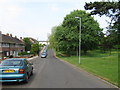
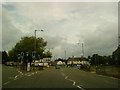

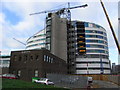


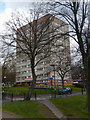
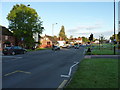
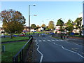

50 photos from this area
Area Information
Key information about the B29 6TQ including its size, population, and administrative classification.
- Area Type
- Postcode
- Area Size
- 7.1 hectares
- Population
- 4344
- Population Density
- 6555 people/km²
House Prices in B29 6TQ
28
Properties
£190,304
Average Sold Price
£40,000
Lowest Price
£440,000
Highest Price
Showing 28 properties
| Address | Type | Beds | Baths | Last Sale Price | Last Sale Date | |
|---|---|---|---|---|---|---|
| 192 Harborne Lane, Selly Oak, Birmingham, B29 6TQ | Semi-detached | 6 | 2 | £440,000 | Jan 2022 | |
| 222 Harborne Lane, Selly Oak, Birmingham, B29 6TQ | Semi-detached | 6 | 2 | £310,000 | Jan 2022 | |
| 190 Harborne Lane, Selly Oak, Birmingham, B29 6TQ | Semi-detached | 1 | 2 | £380,000 | Jan 2022 | |
| 194 Harborne Lane, Selly Oak, Birmingham, B29 6TQ | Semi-detached | 5 | 5 | £310,000 | Dec 2017 | |
| 196 Harborne Lane, Selly Oak, Birmingham, B29 6TQ | Semi-detached | 6 | 1 | £307,000 | Jul 2017 | |
| 206 Harborne Lane, Selly Oak, Birmingham, B29 6TQ | Terraced | 5 | 5 | £310,000 | Jul 2017 | |
| 228 Harborne Lane, Selly Oak, Birmingham, B29 6TQ | Detached | 6 | 6 | £290,000 | Sep 2016 | |
| 178 Harborne Lane, Selly Oak, Birmingham, B29 6TQ | Terraced | - | - | £40,000 | Jan 2011 | |
| 218 Harborne Lane, Selly Oak, Birmingham, B29 6TQ | house | - | - | £265,000 | Nov 2007 | |
| 204 Harborne Lane, Selly Oak, Birmingham, B29 6TQ | Terraced | 4 | 1 | £195,000 | May 2007 |
Page 1 of 3
Energy Efficiency in B29 6TQ
Amenities
Schools
| Rank | School | Type | Entry gender | Ages |
|---|
Explore more schools in this area
Go to Schools tabDemographics
Household Size
Family (3-5 people)
most common
Accommodation Type
Houses
most common
Tenure
35
majority
Ethnic Group
White
most common
Religion
N/A
most common
Household Composition
N/A
most common
Age
22
median
Young Adults (15-29 years)
most common
Household Deprivation
N/A
with no deprivation
NS-SEC
11
in Lower managerial occupations
Explore more demographic insights in this area
Go to Demographics tabPlanning
Planning Constraints
- Flood RiskPremium
- Ramsar Wetland SitesPremium
- Area of Outstanding Natural BeautyPremium
- Protected Nature ReservePremium
- Protected WoodlandPremium