Area Overview for B28 9ER
Photos of B28 9ER
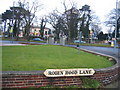
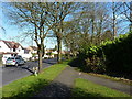
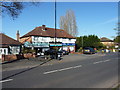
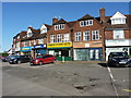

19 photos from this area
Area Information
Key information about the B28 9ER including its size, population, and administrative classification.
- Area Type
- Postcode
- Area Size
- 1.2 hectares
- Population
- 1888
- Population Density
- 6065 people/km²
House Prices in B28 9ER
19
Properties
£188,350
Average Sold Price
£45,500
Lowest Price
£385,000
Highest Price
Showing 19 properties
| Address | Type | Beds | Baths | Last Sale Price | Last Sale Date | |
|---|---|---|---|---|---|---|
| 31 Beechcroft Avenue, Birmingham, B28 9ER | Semi-detached | 3 | 2 | £385,000 | Jun 2025 | |
| 28 Beechcroft Avenue, Birmingham, B28 9ER | Retail | 3 | 1 | £340,000 | Dec 2022 | |
| 25 Beechcroft Avenue, Birmingham, B28 9ER | Semi-detached | 3 | 2 | £292,000 | Mar 2019 | |
| 26 Beechcroft Avenue, Birmingham, B28 9ER | Semi-detached | 3 | - | £213,000 | Jul 2015 | |
| 24 Beechcroft Avenue, Birmingham, B28 9ER | house | - | - | £156,500 | May 2015 | |
| 19 Beechcroft Avenue, Birmingham, B28 9ER | house | - | - | £155,000 | Feb 2013 | |
| 27 Beechcroft Avenue, Birmingham, B28 9ER | house | 3 | - | £158,000 | Feb 2012 | |
| 20 Beechcroft Avenue, Birmingham, B28 9ER | Semi-detached | 3 | 1 | £207,000 | Jul 2010 | |
| 30 Beechcroft Avenue, Birmingham, B28 9ER | Semi-detached | - | - | £153,000 | Dec 2007 | |
| 29 Beechcroft Avenue, Birmingham, B28 9ER | Semi-detached | - | - | £155,000 | Jan 2006 |
Page 1 of 2
Energy Efficiency in B28 9ER
Amenities
Schools
| Rank | School | Type | Entry gender | Ages |
|---|
Explore more schools in this area
Go to Schools tabDemographics
Household Size
Family (3-5 people)
most common
Accommodation Type
Houses
most common
Tenure
70
majority
Ethnic Group
asian_total
most common
Religion
N/A
most common
Household Composition
N/A
most common
Age
47
median
Adults (30-64 years)
most common
Household Deprivation
N/A
with no deprivation
NS-SEC
27
in Lower managerial occupations
Explore more demographic insights in this area
Go to Demographics tabPlanning
Planning Constraints
- Flood RiskPremium
- Ramsar Wetland SitesPremium
- Area of Outstanding Natural BeautyPremium
- Protected Nature ReservePremium
- Protected WoodlandPremium