Area Overview for B28 9EP
Photos of B28 9EP
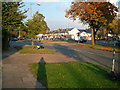

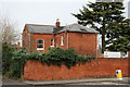
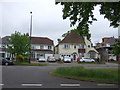
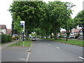
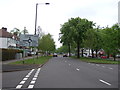
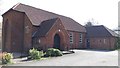
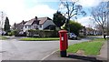
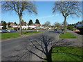
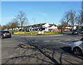
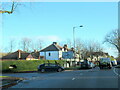
21 photos from this area
Area Information
Key information about the B28 9EP including its size, population, and administrative classification.
- Area Type
- Postcode
- Area Size
- 8300 m²
- Population
- 1888
- Population Density
- 6065 people/km²
House Prices in B28 9EP
14
Properties
£300,255
Average Sold Price
£65,050
Lowest Price
£475,000
Highest Price
Showing 14 properties
| Address | Type | Beds | Baths | Last Sale Price | Last Sale Date | |
|---|---|---|---|---|---|---|
| 1410 Stratford Road, Hall Green, Birmingham, B28 9EP | Semi-detached | 3 | 1 | £417,000 | Dec 2024 | |
| 1408 Stratford Road, Hall Green, Birmingham, B28 9EP | house | - | - | £475,000 | Sep 2024 | |
| 1386 Stratford Road, Hall Green, Birmingham, B28 9EP | Semi-detached | 3 | 2 | £320,500 | Jul 2023 | |
| 1400 Stratford Road, Hall Green, Birmingham, B28 9EP | Semi-detached | 3 | 1 | £390,000 | Mar 2023 | |
| 1388 Stratford Road, Hall Green, Birmingham, B28 9EP | Semi-detached | 3 | 1 | £365,000 | Sep 2021 | |
| 1382 Stratford Road, Hall Green, Birmingham, B28 9EP | Detached | 3 | - | £290,000 | Sep 2019 | |
| 1406 Stratford Road, Hall Green, Birmingham, B28 9EP | house | - | - | £275,000 | Nov 2015 | |
| 1384 Stratford Road, Hall Green, Birmingham, B28 9EP | Semi-detached | - | - | £265,000 | Aug 2007 | |
| 1398 Stratford Road, Hall Green, Birmingham, B28 9EP | Detached | - | - | £140,000 | Oct 1999 | |
| 1394 Stratford Road, Hall Green, Birmingham, B28 9EP | Semi-detached | - | - | £65,050 | Mar 1999 |
Page 1 of 2
Energy Efficiency in B28 9EP
Amenities
Schools
| Rank | School | Type | Entry gender | Ages |
|---|
Explore more schools in this area
Go to Schools tabDemographics
Household Size
Family (3-5 people)
most common
Accommodation Type
Houses
most common
Tenure
70
majority
Ethnic Group
asian_total
most common
Religion
N/A
most common
Household Composition
N/A
most common
Age
47
median
Adults (30-64 years)
most common
Household Deprivation
N/A
with no deprivation
NS-SEC
27
in Lower managerial occupations
Explore more demographic insights in this area
Go to Demographics tabPlanning
Planning Constraints
- Flood RiskPremium
- Ramsar Wetland SitesPremium
- Area of Outstanding Natural BeautyPremium
- Protected Nature ReservePremium
- Protected WoodlandPremium