Area Overview for B21 9HH
Photos of B21 9HH

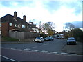
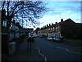

55 photos from this area
Area Information
Key information about the B21 9HH including its size, population, and administrative classification.
- Area Type
- Postcode
- Area Size
- 9600 m²
- Population
- 1632
- Population Density
- 14891 people/km²
House Prices in B21 9HH
52
Properties
£143,462
Average Sold Price
£36,500
Lowest Price
£438,000
Highest Price
Showing 52 properties
| Address | Type | Beds | Baths | Last Sale Price | Last Sale Date | |
|---|---|---|---|---|---|---|
| 44 Douglas Road, Lozells And East Handsworth, Birmingham, B21 9HH | house | 4 | 1 | £200,000 | Jul 2023 | |
| 24 Douglas Road, Lozells And East Handsworth, Birmingham, B21 9HH | Terraced | 3 | 1 | £195,000 | Sep 2022 | |
| 18 Douglas Road, Lozells And East Handsworth, Birmingham, B21 9HH | house | 4 | 2 | £438,000 | Feb 2021 | |
| 60 Douglas Road, Lozells And East Handsworth, Birmingham, B21 9HH | house | - | - | £129,000 | Dec 2020 | |
| 6 Douglas Road, Lozells And East Handsworth, Birmingham, B21 9HH | Terraced | 2 | - | £160,500 | Nov 2018 | |
| 54 Douglas Road, Lozells And East Handsworth, Birmingham, B21 9HH | house | - | - | £110,007 | Sep 2018 | |
| 32 Douglas Road, Lozells And East Handsworth, Birmingham, B21 9HH | Terraced | 3 | 1 | £140,000 | Jul 2018 | |
| 14 Douglas Road, Lozells And East Handsworth, Birmingham, B21 9HH | Terraced | 3 | 1 | £115,000 | Aug 2015 | |
| 58 Douglas Road, Lozells And East Handsworth, Birmingham, B21 9HH | house | 3 | - | £75,000 | Feb 2011 | |
| 38 Douglas Road, Lozells And East Handsworth, Birmingham, B21 9HH | Terraced | 4 | 2 | £100,000 | Dec 2007 |
Page 1 of 6
Energy Efficiency in B21 9HH
Amenities
Schools
| Rank | School | Type | Entry gender | Ages |
|---|
Explore more schools in this area
Go to Schools tabDemographics
Household Size
Family (3-5 people)
most common
Accommodation Type
Houses
most common
Tenure
47
majority
Ethnic Group
asian_total
most common
Religion
N/A
most common
Household Composition
N/A
most common
Age
47
median
Adults (30-64 years)
most common
Household Deprivation
N/A
with no deprivation
NS-SEC
9
in Lower managerial occupations
Explore more demographic insights in this area
Go to Demographics tabPlanning
Planning Constraints
- Flood RiskPremium
- Ramsar Wetland SitesPremium
- Area of Outstanding Natural BeautyPremium
- Protected Nature ReservePremium
- Protected WoodlandPremium