Area Overview for B21 9JN
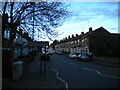
Photos of B21 9JN


Area Information
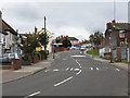
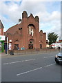
B21 9JN is a small residential postcode cluster nestled in the West Midlands, just 2 kilometres north of Birmingham City Centre. With a population of 1,632, it sits within the historically rich Handsworth Ward, a suburb that evolved from rural origins to an industrial hub during the 18th century. The area’s character is shaped by its layered past: from the Soho Manufactory, where James Watt and Matthew Boulton pioneered steam technology, to its role as a post-war centre for Caribbean immigration. Today, B21 9JN offers a compact, suburban feel with easy access to Birmingham’s cultural and economic heart. Notable landmarks include Handsworth Park, a 19th-century green space once hosting the Birmingham Flower Show, and St Mary’s Church, a 13th-century structure marking the ancient parish boundary. Daily life here blends proximity to urban amenities with a quieter, community-focused rhythm, ideal for those seeking a balance between city convenience and residential tranquillity.
- Area Type
- Postcode
- Area Size
- Not available
- Population
- 1632
- Population Density
- 14891 people/km²
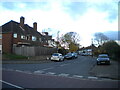
B21 9JN is predominantly a house-based area, with 100% of properties classified as houses rather than flats or apartments. Home ownership here is 47%, which is slightly below the national average, suggesting a significant rental market. This dynamic may appeal to buyers seeking family homes, as the area’s suburban character and historical roots align with traditional housing stock. However, the lower ownership rate could indicate a reliance on private rentals or shared ownership schemes. Given the postcode’s small size, property availability is limited, and buyers may need to consider nearby areas for more options. The focus on houses also means the area is less suited to those prioritising high-density living, though it offers a quieter, more spacious alternative to central Birmingham.
House Prices in B21 9JN
No properties found in this postcode.
Energy Efficiency in B21 9JN
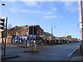
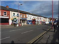
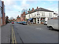
The lifestyle in B21 9JN is shaped by its proximity to essential amenities and green spaces. Within practical reach are five retail outlets, including Iceland Handsworth and Lidl Handsworth, offering everyday shopping convenience. The area’s transport network includes five metro stops and five rail stations, such as Soho Benson Road and Handsworth Booth Street, facilitating easy access to Birmingham’s commercial and cultural hubs. A key highlight is Handsworth Park, a 19th-century green space that hosts community events and offers recreational opportunities. The mix of retail, transport, and open space creates a balanced lifestyle, blending suburban comfort with urban accessibility.
Amenities
Schools
B21 9JN is served by three primary schools: Grove School, Grove Infant and Nursery School, and Grove Junior School. All three are primary institutions, providing a comprehensive early education network for families with young children. Grove School holds a ‘good’ Ofsted rating, reflecting its quality of teaching and facilities. The presence of three primary schools in close proximity suggests a strong emphasis on education within the community, reducing the need for long commutes to schools. However, the absence of secondary schools in the immediate area means families may need to look further afield for high school options. The concentration of primary schools makes B21 9JN an attractive choice for parents prioritising accessible early education.
| Rank | School | Type | Entry gender | Ages |
|---|
Explore more schools in this area
Go to Schools tabDemographics
The population of B21 9JN is 1,632, with a median age of 47 and the most common age group being adults aged 30–64. This suggests a mature, established community with a strong presence of middle-aged residents. Home ownership stands at 47%, indicating a mix of owner-occupied and rental properties. The predominant accommodation type is houses, reflecting a suburban layout rather than high-density housing. The area’s predominant ethnic group is Asian, highlighting its cultural diversity. While specific deprivation data is not provided, the age profile and ownership rates suggest a stable, long-term resident base. The absence of detailed deprivation metrics means it is difficult to assess socioeconomic challenges, but the demographic mix implies a community with varied needs and potentially strong social networks.
Household Size
Accommodation Type
Tenure
Ethnic Group
Religion
Household Composition
Age
Household Deprivation
NS-SEC
Explore more demographic insights in this area
Go to Demographics tabPlanning
Planning Constraints
- Flood RiskPremium
- Ramsar Wetland SitesPremium
- Area of Outstanding Natural BeautyPremium
- Protected Nature ReservePremium
- Protected WoodlandPremium