Area Overview for B20 2PL
Photos of B20 2PL
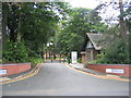
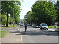
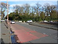
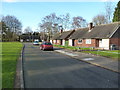
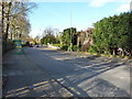
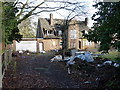
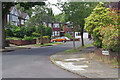
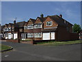
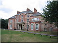
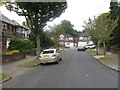
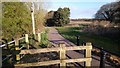
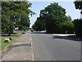
13 photos from this area
Area Information
Key information about the B20 2PL including its size, population, and administrative classification.
- Area Type
- Postcode
- Area Size
- 1.3 hectares
- Population
- 1787
- Population Density
- 4278 people/km²
House Prices in B20 2PL
9
Properties
£384,400
Average Sold Price
£159,000
Lowest Price
£845,000
Highest Price
Showing 9 properties
| Address | Type | Beds | Baths | Last Sale Price | Last Sale Date | |
|---|---|---|---|---|---|---|
| 90 Handsworth Wood Road, Birmingham, B20 2PL | Detached | 2 | 2 | £845,000 | May 2025 | |
| 92 Handsworth Wood Road, Birmingham, B20 2PL | Detached | 8 | 5 | £498,000 | Mar 2008 | |
| 86A Handsworth Wood Road, Birmingham, B20 2PL | Semi-detached | - | - | £170,000 | Sep 2006 | |
| 84 Handsworth Wood Road, Birmingham, B20 2PL | Semi-detached | - | - | £250,000 | Oct 2005 | |
| 86 Handsworth Wood Road, Birmingham, B20 2PL | house | - | - | £159,000 | Sep 2003 | |
| Living Accomodation, Sheriden House Hotel, 82 Handsworth Wood Road, Birmingham, B20 2PL | Detached | 12 | 13 | - | - | |
| 90B Handsworth Wood Road, Birmingham, B20 2PL | office_workshop | - | - | - | - | |
| 90A Handsworth Wood Road, Birmingham, B20 2PL | house | - | - | - | - | |
| 1ST Care Limited, 88 Handsworth Wood Road, Birmingham, B20 2PL | Retirement | - | - | - | - |
Energy Efficiency in B20 2PL
Amenities
Schools
| Rank | School | Type | Entry gender | Ages |
|---|
Explore more schools in this area
Go to Schools tabDemographics
Household Size
Family (3-5 people)
most common
Accommodation Type
Houses
most common
Tenure
75
majority
Ethnic Group
asian_total
most common
Religion
N/A
most common
Household Composition
N/A
most common
Age
47
median
Adults (30-64 years)
most common
Household Deprivation
N/A
with no deprivation
NS-SEC
32
in Lower managerial occupations
Explore more demographic insights in this area
Go to Demographics tabPlanning
Planning Constraints
- Flood RiskPremium
- Ramsar Wetland SitesPremium
- Area of Outstanding Natural BeautyPremium
- Protected Nature ReservePremium
- Protected WoodlandPremium