Area Overview for B20 2LU
Photos of B20 2LU
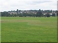
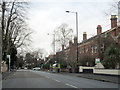
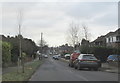
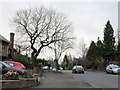
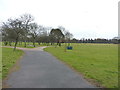
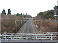
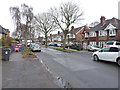
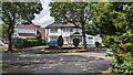
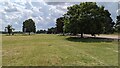
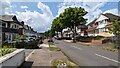
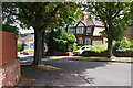
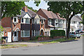
17 photos from this area
Area Information
Key information about the B20 2LU including its size, population, and administrative classification.
- Area Type
- Postcode
- Area Size
- 7467 m²
- Population
- 1737
- Population Density
- 3895 people/km²
House Prices in B20 2LU
17
Properties
£166,350
Average Sold Price
£56,900
Lowest Price
£250,000
Highest Price
Showing 17 properties
| Address | Type | Beds | Baths | Last Sale Price | Last Sale Date | |
|---|---|---|---|---|---|---|
| 70 West Avenue, Birmingham, B20 2LU | Semi-detached | 3 | 1 | £250,000 | Nov 2019 | |
| 68 West Avenue, Birmingham, B20 2LU | house | - | - | £240,000 | Oct 2018 | |
| 55 West Avenue, Birmingham, B20 2LU | Semi-detached | 4 | 2 | £150,000 | Apr 2014 | |
| 74 West Avenue, Birmingham, B20 2LU | house | - | - | £140,000 | Dec 2013 | |
| 84 West Avenue, Birmingham, B20 2LU | house | - | - | £220,000 | Dec 2010 | |
| 66 West Avenue, Birmingham, B20 2LU | Semi-detached | - | - | £235,000 | Apr 2008 | |
| 64 West Avenue, Birmingham, B20 2LU | house | - | - | £203,000 | Mar 2008 | |
| 78 West Avenue, Birmingham, B20 2LU | Semi-detached | 3 | 1 | £160,000 | Jun 2004 | |
| 72 West Avenue, Birmingham, B20 2LU | Semi-detached | - | - | £105,950 | Aug 2001 | |
| 76 West Avenue, Birmingham, B20 2LU | Semi-detached | - | - | £56,900 | Jul 2000 |
Page 1 of 2
Energy Efficiency in B20 2LU
Amenities
Schools
| Rank | School | Type | Entry gender | Ages |
|---|
Explore more schools in this area
Go to Schools tabDemographics
Household Size
Family (3-5 people)
most common
Accommodation Type
Houses
most common
Tenure
82
majority
Ethnic Group
asian_total
most common
Religion
N/A
most common
Household Composition
N/A
most common
Age
47
median
Adults (30-64 years)
most common
Household Deprivation
N/A
with no deprivation
NS-SEC
35
in Lower managerial occupations
Explore more demographic insights in this area
Go to Demographics tabPlanning
Planning Constraints
- Flood RiskPremium
- Ramsar Wetland SitesPremium
- Area of Outstanding Natural BeautyPremium
- Protected Nature ReservePremium
- Protected WoodlandPremium