Area Overview for B17 0BL
Photos of B17 0BL
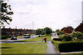
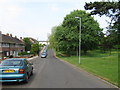
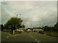
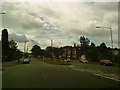
50 photos from this area
Area Information
Key information about the B17 0BL including its size, population, and administrative classification.
- Area Type
- Postcode
- Area Size
- 9001 m²
- Population
- 1693
- Population Density
- 1834 people/km²
House Prices in B17 0BL
19
Properties
£270,111
Average Sold Price
£108,000
Lowest Price
£545,000
Highest Price
Showing 19 properties
| Address | Type | Beds | Baths | Last Sale Price | Last Sale Date | |
|---|---|---|---|---|---|---|
| 280 Harborne Park Road, Birmingham, B17 0BL | house | - | - | £315,000 | Apr 2021 | |
| 272 Harborne Park Road, Birmingham, B17 0BL | Semi-detached | 1 | 1 | £545,000 | Feb 2020 | |
| 268 Harborne Park Road, Birmingham, B17 0BL | Detached | 7 | 4 | £330,000 | Aug 2011 | |
| 258 Harborne Park Road, Birmingham, B17 0BL | Detached | 3 | 1 | £234,000 | Apr 2010 | |
| 274 Harborne Park Road, Birmingham, B17 0BL | Semi-detached | - | - | £375,000 | May 2008 | |
| 256 Harborne Park Road, Birmingham, B17 0BL | Detached | 4 | 2 | £229,000 | Aug 2007 | |
| 254 Harborne Park Road, Birmingham, B17 0BL | house | - | - | £108,000 | Feb 2000 | |
| 276 Harborne Park Road, Birmingham, B17 0BL | Semi-detached | - | - | £155,000 | Jul 1999 | |
| 270 Harborne Park Road, Birmingham, B17 0BL | Semi-detached | - | - | £140,000 | Oct 1998 | |
| 266 Harborne Park Road, Birmingham, B17 0BL | house | 6 | 2 | - | - |
Page 1 of 2
Energy Efficiency in B17 0BL
Amenities
Schools
| Rank | School | Type | Entry gender | Ages |
|---|
Explore more schools in this area
Go to Schools tabDemographics
Household Size
One person
most common
Accommodation Type
Houses
most common
Tenure
49
majority
Ethnic Group
White
most common
Religion
N/A
most common
Household Composition
N/A
most common
Age
47
median
Adults (30-64 years)
most common
Household Deprivation
N/A
with no deprivation
NS-SEC
43
in Lower managerial occupations
Explore more demographic insights in this area
Go to Demographics tabPlanning
Planning Constraints
- Flood RiskPremium
- Ramsar Wetland SitesPremium
- Area of Outstanding Natural BeautyPremium
- Protected Nature ReservePremium
- Protected WoodlandPremium