Area Overview for B17 0BN
Photos of B17 0BN
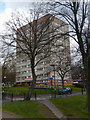
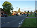
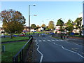
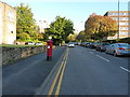
50 photos from this area
Area Information
Key information about the B17 0BN including its size, population, and administrative classification.
- Area Type
- Postcode
- Area Size
- 1.1 hectares
- Population
- 1693
- Population Density
- 1834 people/km²
House Prices in B17 0BN
33
Properties
£274,065
Average Sold Price
£72,000
Lowest Price
£374,000
Highest Price
Showing 33 properties
| Address | Type | Beds | Baths | Last Sale Price | Last Sale Date | |
|---|---|---|---|---|---|---|
| 31 Denise Drive, Birmingham, B17 0BN | house | - | - | £330,000 | Feb 2025 | |
| 18 Denise Drive, Birmingham, B17 0BN | Semi-detached | 3 | 1 | £315,000 | Apr 2024 | |
| 3 Denise Drive, Birmingham, B17 0BN | house | - | - | £374,000 | Sep 2021 | |
| 27 Denise Drive, Birmingham, B17 0BN | Semi-detached | 3 | 1 | £309,000 | Jan 2020 | |
| 8 Denise Drive, Birmingham, B17 0BN | Semi-detached | 3 | 1 | £298,000 | Jun 2019 | |
| 7 Denise Drive, Birmingham, B17 0BN | house | - | - | £300,000 | May 2019 | |
| 14 Denise Drive, Birmingham, B17 0BN | Semi-detached | 3 | 1 | £295,000 | Oct 2017 | |
| 29 Denise Drive, Birmingham, B17 0BN | Semi-detached | 3 | 1 | £299,950 | Jun 2017 | |
| 6 Denise Drive, Birmingham, B17 0BN | house | - | - | £276,000 | Feb 2016 | |
| 10 Denise Drive, Birmingham, B17 0BN | Semi-detached | 3 | - | £255,000 | Dec 2015 |
Page 1 of 4
Energy Efficiency in B17 0BN
Amenities
Schools
| Rank | School | Type | Entry gender | Ages |
|---|
Explore more schools in this area
Go to Schools tabDemographics
Household Size
One person
most common
Accommodation Type
Houses
most common
Tenure
49
majority
Ethnic Group
White
most common
Religion
N/A
most common
Household Composition
N/A
most common
Age
47
median
Adults (30-64 years)
most common
Household Deprivation
N/A
with no deprivation
NS-SEC
43
in Lower managerial occupations
Explore more demographic insights in this area
Go to Demographics tabPlanning
Planning Constraints
- Flood RiskPremium
- Ramsar Wetland SitesPremium
- Area of Outstanding Natural BeautyPremium
- Protected Nature ReservePremium
- Protected WoodlandPremium