Area Overview for B17 0LL
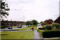
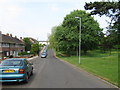
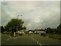
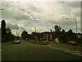
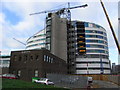
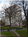
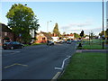
Photos of B17 0LL


Area Information
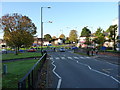
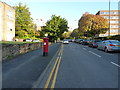
Living in B17 0LL means being part of a small, residential cluster in Harborne, a historic village in Birmingham’s southwest. With a population of 1,693, this area retains a village character centred on Harborne High Street and St Peter’s Church, which dates back to the 13th century. The settlement’s roots stretch to the Domesday Book of 1086, though it was formally incorporated into Birmingham in 1891. Today, B17 0LL offers a quiet, low-density living environment, with homes predominantly in the form of houses. The area is served by nearby schools, rail links, and retail hubs, blending historical charm with modern convenience. Its proximity to Birmingham’s city centre and surrounding suburbs makes it accessible for commuters, while its low crime rate and strong broadband connectivity cater to both families and professionals. For those seeking a balance between tradition and practicality, B17 0LL provides a distinct alternative to larger urban zones.
- Area Type
- Postcode
- Area Size
- Not available
- Population
- 1693
- Population Density
- 1834 people/km²
The property market in B17 0LL is characterised by a 49% home ownership rate, suggesting a balance between owner-occupied and rental properties. Given the accommodation type is primarily houses, the area likely features larger, more traditional homes compared to flats or apartments. This mix may appeal to families seeking space or professionals looking for stable, long-term housing. However, the small size of the postcode area—covering a single residential cluster—means the housing stock is limited, which could affect availability and competition for properties. The predominance of houses implies a focus on private, low-density living, potentially offering more privacy than urban developments. For buyers, this suggests a niche market with fewer options but potentially higher quality of build. The area’s proximity to Birmingham’s city centre and transport links may also make it attractive for commuters seeking a quieter base outside the urban core.
House Prices in B17 0LL
No properties found in this postcode.
Energy Efficiency in B17 0LL
Daily life in B17 0LL is enriched by nearby amenities, including retail outlets such as M&S Birmingham QE Hospital, Waitrose Harborne, and Asda Harborne. These shops provide convenience for grocery shopping and everyday needs. The area’s transport links—rail and metro stations—connect residents to Birmingham’s cultural and commercial hubs, including Edgbaston Village and Centenary Square. Historically, Harborne High Street has been a focal point, with its mix of old inns, churches, and local businesses. The presence of St Peter’s Church and other landmarks adds a sense of heritage to the area. For leisure, nearby parks and green spaces, though not explicitly named, may be accessible through the surrounding suburbs. The blend of traditional village charm and modern amenities makes B17 0LL a practical choice for those seeking both convenience and a connection to history.
Amenities
Schools
B17 0LL is served by a range of schools, including St Peter’s Church of England Junior School and St Peter’s Church of England Infant and Nursery School, both primary institutions. Eccleston School, an independent school, adds a private option for families. St Peters CofE Primary School holds a good Ofsted rating, indicating a reliable standard of education. The mix of state and independent schools provides flexibility for parents, whether they prioritise affordability or specialised curricula. For families with young children, the presence of multiple primary schools within reach reduces the need for long commutes. The good Ofsted rating at St Peters CofE Primary School suggests a strong focus on academic and pastoral care, which can be reassuring for parents seeking quality education. However, the absence of secondary schools in the immediate area may require families to consider nearby options in Birmingham’s broader network.
| Rank | School | Type | Entry gender | Ages |
|---|
Explore more schools in this area
Go to Schools tabDemographics
The community in B17 0LL is predominantly composed of adults aged 30–64, with a median age of 47. This suggests a mature, stable population, likely with established careers and family ties. Home ownership sits at 49%, indicating a mix of owner-occupied and rental properties. The area’s accommodation is largely houses, reflecting a preference for single-family living. The predominant ethnic group is White, though no specific diversity statistics are provided. With a population of 1,693, the area is small enough to foster a close-knit community but large enough to support essential services. The age profile implies a focus on middle-aged residents, possibly with children in local schools, though the absence of youth demographics means younger families may be less represented. This demographic structure aligns with a quiet, settled environment rather than a rapidly growing or transient population.
Household Size
Accommodation Type
Tenure
Ethnic Group
Religion
Household Composition
Age
Household Deprivation
NS-SEC
Explore more demographic insights in this area
Go to Demographics tabPlanning
Planning Constraints
- Flood RiskPremium
- Ramsar Wetland SitesPremium
- Area of Outstanding Natural BeautyPremium
- Protected Nature ReservePremium
- Protected WoodlandPremium