Area Overview for B16 9SL
Photos of B16 9SL

Area Information
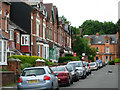
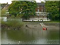
Living in B16 9SL means being part of a compact, residential postcode in the heart of Birmingham’s North Edgbaston ward. This small area, covering just 1.0 hectare, is home to 2,077 people, making it one of the city’s more densely populated neighbourhoods, with a population density of 198,908 people per square kilometre. Despite its size, it sits in a historically significant part of Birmingham, once a 19th-century retreat for wealthier residents, known for its tree-lined streets and avoidance of industrial development. The area’s proximity to Birmingham city centre offers easy access to urban amenities, yet its small footprint fosters a quiet, community-focused atmosphere. Residents benefit from nearby landmarks such as Edgbaston Hall, a Grade II listed building, and Edgbaston Pool, a Site of Special Scientific Interest. The ward’s mix of retail, transport, and green spaces creates a balance between convenience and tranquillity, ideal for those seeking a blend of city living and historical charm.
- Area Type
- Postcode
- Area Size
- 1.0 hectares
- Population
- 2077
- Population Density
- 5483 people/km²
The property market in B16 9SL is defined by its high density and limited space. With only 1.0 hectare of land, the area is constrained, and the predominant accommodation type—flats—suggests a focus on multi-unit housing. Home ownership is low at 29%, meaning the majority of residents are renters, likely in purpose-built flats or converted properties. This dynamic points to a rental market rather than a buyers’ market, which may present challenges for those seeking to purchase property. The small area size also means that housing stock is limited, potentially increasing competition among buyers. For those considering the area, the compact nature of B16 9SL could be a drawback, but it also ensures proximity to amenities and transport links. The lack of larger homes or detached properties means that buyers should approach the market with realistic expectations, prioritising location over property size.
House Prices in B16 9SL
Showing 3 properties
| Address | Type | Beds | Baths | Last Sale Price | Last Sale Date | |
|---|---|---|---|---|---|---|
| Tennis 69M From St Pauls Convent, 45 Vernon Road 81M From Unnamed Road, Vernon Road, Birmingham, B16 9SL | Leisure | - | - | - | - | |
| Tennis 62M From 79 Mariner Avenue 77M From Mariner Avenue, Mariner Avenue, Birmingham, B16 9SL | Leisure | - | - | - | - | |
| St Pauls Convent, 45 Vernon Road, Birmingham, B16 9SL | commercial | - | - | - | - |
Energy Efficiency in B16 9SL
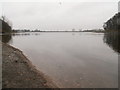
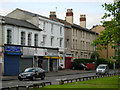
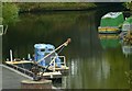
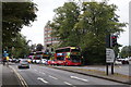
Life in B16 9SL is enriched by a range of nearby amenities within practical reach. Retail options include Tesco Hagley, Spar Ample, and Tesco Edgbaston, providing essential shopping and dining choices. The area’s proximity to metro stops like Edgbaston Village and Centenary Square connects residents to Birmingham’s cultural and commercial centres. Rail stations such as Five Ways and University Railway Station offer swift access to the city and beyond. Historically significant sites, including Edgbaston Hall—a Grade II listed building—add character to the neighbourhood, while Edgbaston Pool, a Site of Special Scientific Interest, offers green space for leisure. The blend of retail, transport, and heritage sites creates a convenient, dynamic lifestyle, balancing urban accessibility with pockets of historical and natural value.
Amenities
Schools
The nearest school to B16 9SL is St Paul’s School for Girls, a primary school with an outstanding Ofsted rating. This indicates high-quality education for younger children, though the data does not mention secondary schools or other educational institutions in the immediate vicinity. The presence of a top-rated primary school is a significant draw for families, as it ensures access to a well-regarded early education system. However, prospective homebuyers should verify whether secondary schooling options are available within a reasonable distance, as the data does not specify. For families prioritising primary education, St Paul’s School for Girls offers a strong foundation, but the overall school ecosystem in the area remains unclear without additional information.
| Rank | School | Type | Entry gender | Ages |
|---|
Explore more schools in this area
Go to Schools tabDemographics
The community in B16 9SL is predominantly composed of adults aged 30–64, with a median age of 47. This suggests a mature population, likely settled in long-term housing or retirement. Home ownership is relatively low at 29%, indicating that most residents rent their homes, which may reflect the area’s mix of rental flats and limited availability of owner-occupied properties. The accommodation type is largely flats, a common feature in high-density urban areas. The predominant ethnic group is White, though the data does not specify further diversity metrics. With a population density over 198,000 per square kilometre, the area is tightly packed, which may influence the character of daily life—more communal and less spread out than suburban settings. The age profile suggests a stable, established community, though the low home ownership rate could indicate a transient population or a focus on rental markets.
Household Size
Accommodation Type
Tenure
Ethnic Group
Religion
Household Composition
Age
Household Deprivation
NS-SEC
Explore more demographic insights in this area
Go to Demographics tabPlanning
Planning Constraints
- Flood RiskPremium
- Ramsar Wetland SitesPremium
- Area of Outstanding Natural BeautyPremium
- Protected Nature ReservePremium
- Protected WoodlandPremium