Area Overview for B15 2PA
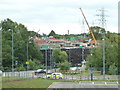
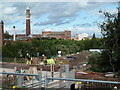
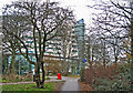
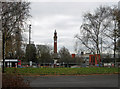
Photos of B15 2PA
Area Information
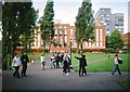
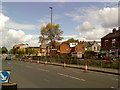
Living in B15 2PA means inhabiting a compact, residential postcode in the southwest of Birmingham, where suburban tranquillity meets urban accessibility. The area covers 6.3 hectares and is home to 2,550 people, with a population density of 2,388 people per square kilometre. This small cluster sits within the broader Edgbaston area, historically a magnet for affluent residents due to its green spaces, historic homes, and proximity to the city centre. The ward includes parts of Edgbaston, Harborne, and Quinton, with a legacy of private housing and tree-lined streets. While the area is modest in size, it offers a distinct character shaped by its 19th-century origins, including connections to figures like J.R.R. Tolkien and Cardinal Newman. Residents benefit from proximity to Birmingham’s cultural and commercial hubs, yet retain a suburban feel defined by parks and low-rise housing. The postcode’s compact nature means amenities and services are within practical reach, making it a viable choice for those seeking a balance between city life and quieter living.
- Area Type
- Postcode
- Area Size
- 6.3 hectares
- Population
- 2550
- Population Density
- 2388 people/km²
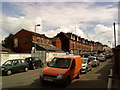
The property market in B15 2PA is characterised by a low home ownership rate (35%) and a focus on houses rather than flats or apartments. This suggests the area is more rental-oriented, with a higher proportion of tenants than owners. The prevalence of houses indicates a mix of older, historic properties and newer builds, likely reflecting the area’s suburban heritage. Given the postcode’s small size (6.3 hectares) and high population density, the housing stock is limited, which may affect availability for buyers. For those seeking property, the market may cater more to investors or long-term renters than first-time buyers. The compact nature of the area means proximity to Birmingham’s amenities is a key selling point, though buyers should consider the lack of expansion potential and the need for careful planning when evaluating properties.
House Prices in B15 2PA
Showing 1 properties
| Address | Type | Beds | Baths | Last Sale Price | Last Sale Date | |
|---|---|---|---|---|---|---|
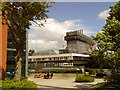
| Institute Of Cancer Research, Vincent Drive, Birmingham, B15 2PA | commercial | - | - | - | - |
Energy Efficiency in B15 2PA
Residents of B15 2PA have access to a range of amenities within practical reach, including retail options like M&S Birmingham QE Hospital, Spar, and Tesco Selly Oak Bristol. The area’s proximity to Edgbaston Village, Centenary Square, and Town Hall offers leisure and cultural opportunities, from dining to shopping. While the postcode itself is small, its integration with larger Edgbaston means nearby parks, historic sites, and green spaces are accessible. Notable landmarks include Edgbaston Hall (now a golf club) and the Birmingham Oratory, reflecting the area’s heritage. The mix of retail, transport hubs, and green spaces contributes to a balanced lifestyle, blending suburban comfort with urban convenience. However, the compact nature of the area means some services may require a short trip beyond the immediate postcode.
Amenities
Schools
| Rank | School | Type | Entry gender | Ages |
|---|
Explore more schools in this area
Go to Schools tabDemographics
The population of B15 2PA is 2,550, with a median age of 47 and the most common age range being adults aged 30–64. This suggests a community skewed towards middle-aged and older residents, likely including professionals and families. Home ownership here is relatively low at 35%, indicating a higher proportion of renters compared to owner-occupied properties. The predominant accommodation type is houses, reflecting a mix of older, historic homes and more recent builds. The predominant ethnic group is White, though no specific diversity statistics are provided. The age profile and ownership figures suggest a stable, established community with fewer young families or transient populations. The high population density—2,388 people per square kilometre—means the area is compact, with limited space for expansion, which could influence housing availability and local services.
Household Size
Accommodation Type
Tenure
Ethnic Group
Religion
Household Composition
Age
Household Deprivation
NS-SEC
Explore more demographic insights in this area
Go to Demographics tabPlanning
Planning Constraints
- Flood RiskPremium
- Ramsar Wetland SitesPremium
- Area of Outstanding Natural BeautyPremium
- Protected Nature ReservePremium
- Protected WoodlandPremium