Area Overview for B15 2SG
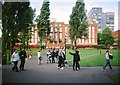
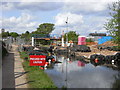
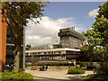
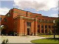
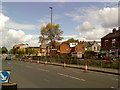
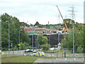
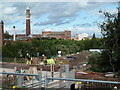
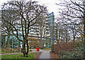
Photos of B15 2SG


Area Information
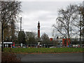
Living in B15 2SG means inhabiting a compact, suburban enclave within Birmingham’s southwest quadrant. This postcode area, spanning 2.2 hectares, is home to 2,444 residents, reflecting a densely populated yet small-scale community. Its proximity to the city centre and historical ties to Edgbaston—once a Warwickshire village—create a blend of suburban tranquillity and urban accessibility. The area’s character is defined by its green spaces, historic private homes, and a legacy of affluence. Young adults dominate, with a median age of 22, suggesting a dynamic, student-influenced demographic. Nearby landmarks like Edgbaston Hall and the Birmingham Oratory hint at the area’s architectural and cultural heritage. For buyers, B15 2SG offers a compact, well-connected slice of Birmingham, ideal for those seeking proximity to the city’s core while retaining a distinct suburban identity.
- Area Type
- Postcode
- Area Size
- 2.2 hectares
- Population
- 2444
- Population Density
- 1053 people/km²
The property market in B15 2SG is characterised by a 49% home ownership rate, with flats making up the majority of accommodation. This suggests a rental-driven market, where owner-occupiers are a minority. The small area size—just 2.2 hectares—means housing stock is limited, likely concentrated in multi-unit developments or converted properties. Flats may dominate due to the area’s density and historical development patterns. For buyers, this implies a focus on rental properties or smaller units, with limited scope for large family homes. The proximity to Birmingham’s city centre and transport links could make it attractive for investors, though the high population density may limit availability. Those seeking long-term ownership may need to consider nearby areas for more diverse options.
House Prices in B15 2SG
Showing 3 properties
| Address | Type | Beds | Baths | Last Sale Price | Last Sale Date | |
|---|---|---|---|---|---|---|
| Part First Floor, 90 Vincent Drive, Birmingham, B15 2SG | Office | - | - | - | - | |
| West Midlands Regional Blood Transfusion Service, Vincent Drive, Birmingham, B15 2SG | Office | - | - | - | - | |
| 90 Vincent Drive, Birmingham, B15 2SG | commercial | - | - | - | - |
Energy Efficiency in B15 2SG
Residents of B15 2SG enjoy proximity to retail and leisure hubs, including Spar, M&S Birmingham QE Hospital, and Tesco Selly Oak Bristol. The nearby metro areas of Edgbaston Village, Centenary Square, and Town Hall offer dining, shopping, and cultural amenities. The area’s suburban character, with green spaces and historic homes, contrasts with the vibrancy of Birmingham’s city centre. While specific parks or recreational facilities are not listed, the broader Edgbaston area is noted for its trees and open spaces. This blend of suburban calm and urban accessibility makes daily life convenient, with shops, transport, and cultural attractions within reach. The mix of retail and public spaces supports a lifestyle that balances local convenience with city-wide opportunities.
Amenities
Schools
Residents of B15 2SG have access to a mix of independent and higher education institutions. King Edward’s School and King Edward VI High School for Girls are both independent institutions, offering private education options for families. The University of Birmingham, though not a traditional school, is a major nearby educational hub, influencing the area’s academic atmosphere. The presence of independent schools suggests a community prioritising private education, though no Ofsted ratings are available. The combination of high-quality independent institutions and university proximity makes B15 2SG appealing for families seeking strong educational environments. However, the lack of state school data means potential buyers should investigate further for comprehensive schooling options.
| Rank | School | Type | Entry gender | Ages |
|---|
Explore more schools in this area
Go to Schools tabDemographics
B15 2SG’s population skews heavily towards young adults, with 15–29-year-olds forming the most common age group. The median age of 22 underscores a community shaped by students and early-career professionals. Home ownership sits at 49%, with flats being the predominant accommodation type. This suggests a rental market with limited long-term owner-occupied properties, reflecting the area’s appeal to transient or younger demographics. The predominant ethnic group is White, though specific diversity metrics are not provided. With 1,053 people per square kilometre, the density is high for its size, which may impact communal living and local amenities. The demographic profile indicates a vibrant, youthful environment, potentially influenced by nearby educational institutions like the University of Birmingham.
Household Size
Accommodation Type
Tenure
Ethnic Group
Religion
Household Composition
Age
Household Deprivation
NS-SEC
Explore more demographic insights in this area
Go to Demographics tabPlanning
Planning Constraints
- Flood RiskPremium
- Ramsar Wetland SitesPremium
- Area of Outstanding Natural BeautyPremium
- Protected Nature ReservePremium
- Protected WoodlandPremium