Area Overview for B15 2TH
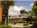
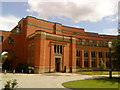
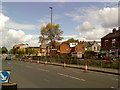
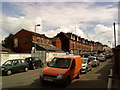
Photos of B15 2TH
Area Information
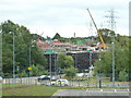
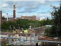
Living in B15 2TH means inhabiting a compact, suburban enclave within Birmingham’s Edgbaston area, known for its green spaces and historic character. With a population of 2,550 and a density of 2,388 people per square kilometre, this postcode reflects a tightly knit community. The area’s roots trace back to the 19th century, when wealthy residents were drawn to its tree-lined streets and private homes, a legacy still evident today. Modern residents benefit from proximity to Birmingham’s city centre, with easy access to rail and metro networks. The area’s appeal lies in its balance of suburban tranquillity and urban connectivity, though its small size means amenities are concentrated within a short reach. For those seeking a residential area with a distinct identity, B15 2TH offers a mix of historic charm and practical modernity, though its high crime risk score of 1 (out of 100) demands caution. The broadband score of 99 ensures seamless digital access, supporting remote work and daily connectivity.
- Area Type
- Postcode
- Area Size
- Not available
- Population
- 2550
- Population Density
- 2388 people/km²
The property market in B15 2TH is defined by its focus on houses, with no flats or apartments present. At 35% home ownership, the area is not heavily dominated by owner-occupied properties, suggesting a significant proportion of the housing stock is rented. This dynamic may appeal to buyers seeking a suburban home but could also mean limited availability for purchase. The presence of houses, rather than high-density housing, aligns with the area’s historic character and low-rise development. Given its small size, the market is likely constrained by limited land for new builds, making existing properties highly sought after. Buyers should consider the area’s compact nature and proximity to Birmingham’s amenities, though the high crime risk may influence investment decisions. The market’s stability is supported by its established infrastructure and transport links, though demand could be tempered by concerns over safety.
House Prices in B15 2TH
Showing 2 properties
| Address | Type | Beds | Baths | Last Sale Price | Last Sale Date | |
|---|---|---|---|---|---|---|
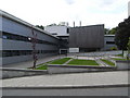
| Institute Of Translational Medicine Heritage Building, Queen Elizabeth Hospital, Mindelsohn Way, Birmingham, B15 2TH | commercial | - | - | - | - | |
| Heritage Building, Queen Elizabeth Hospital, Mindelsohn Way, Birmingham, B15 2TH | office_workshop | - | - | - | - |
Energy Efficiency in B15 2TH
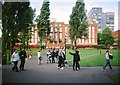
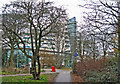
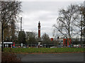
Life in B15 2TH is shaped by its proximity to key amenities within walking or short-vehicle distance. Retail options include M&S Birmingham QE Hospital, Spar, and Tesco Selly Oak Bristol, offering everyday shopping needs. The area’s transport links—five railway stations and metro stops like Edgbaston Village—provide easy access to Birmingham’s cultural and commercial districts. While the area’s suburban character includes historic homes and green spaces, its lifestyle is defined by convenience rather than expansive parks. The nearby Edgbaston Hall, now a golf club, and Grade I-listed properties reflect the area’s heritage, though recreational facilities are limited to nearby city amenities. Residents benefit from a compact, efficient setup, where daily essentials are close at hand, though the lack of large-scale leisure options may require travel beyond the immediate postcode.
Amenities
Schools
| Rank | School | Type | Entry gender | Ages |
|---|
Explore more schools in this area
Go to Schools tabDemographics
The community in B15 2TH is predominantly middle-aged, with a median age of 47 and the majority of residents falling within the 30-64 age range. This suggests a population of established professionals and families, rather than a younger or elderly demographic. Home ownership is relatively low at 35%, indicating a mix of owner-occupied properties and rental homes. The area is characterised by houses, not flats or apartments, reflecting a preference for traditional residential formats. The predominant ethnic group is White, though specific data on diversity is not provided. The high population density—2,388 people per square kilometre—means the area is compact, with limited space for expansion. This density, combined with the age profile, suggests a stable, long-term resident base, though the low home ownership rate may indicate a reliance on rental markets or shared housing.
Household Size
Accommodation Type
Tenure
Ethnic Group
Religion
Household Composition
Age
Household Deprivation
NS-SEC
Explore more demographic insights in this area
Go to Demographics tabPlanning
Planning Constraints
- Flood RiskPremium
- Ramsar Wetland SitesPremium
- Area of Outstanding Natural BeautyPremium
- Protected Nature ReservePremium
- Protected WoodlandPremium