Area Overview for B14 6LU
Photos of B14 6LU
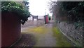
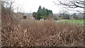
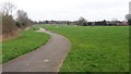
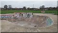
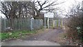
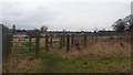
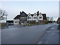
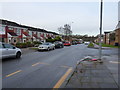
24 photos from this area
Area Information
Key information about the B14 6LU including its size, population, and administrative classification.
- Area Type
- Postcode
- Area Size
- 8530 m²
- Population
- 1458
- Population Density
- 7427 people/km²
House Prices in B14 6LU
24
Properties
£196,133
Average Sold Price
£39,000
Lowest Price
£315,000
Highest Price
Showing 24 properties
| Address | Type | Beds | Baths | Last Sale Price | Last Sale Date | |
|---|---|---|---|---|---|---|
| 16 Yarningale Road, Birmingham, B14 6LU | house | - | - | £300,000 | Mar 2021 | |
| 42 Yarningale Road, Birmingham, B14 6LU | Semi-detached | 3 | 1 | £253,000 | Dec 2019 | |
| 54 Yarningale Road, Birmingham, B14 6LU | Semi-detached | 3 | 1 | £239,000 | Oct 2019 | |
| 8 Yarningale Road, Birmingham, B14 6LU | Semi-detached | 3 | 1 | £265,000 | Aug 2018 | |
| 32 Yarningale Road, Birmingham, B14 6LU | Semi-detached | 3 | 1 | £315,000 | Aug 2018 | |
| 28 Yarningale Road, Birmingham, B14 6LU | Terraced | - | - | £85,000 | Feb 2017 | |
| 18 Yarningale Road, Birmingham, B14 6LU | Semi-detached | 3 | 1 | £235,000 | Mar 2016 | |
| 12 Yarningale Road, Birmingham, B14 6LU | Semi-detached | 3 | 1 | £215,000 | Aug 2015 | |
| 50 Yarningale Road, Birmingham, B14 6LU | Semi-detached | 3 | - | £215,000 | Oct 2014 | |
| 56 Yarningale Road, Birmingham, B14 6LU | Semi-detached | 3 | 1 | £155,000 | Aug 2014 |
Page 1 of 3
Energy Efficiency in B14 6LU
Amenities
Schools
| Rank | School | Type | Entry gender | Ages |
|---|
Explore more schools in this area
Go to Schools tabDemographics
Household Size
Family (3-5 people)
most common
Accommodation Type
Houses
most common
Tenure
57
majority
Ethnic Group
White
most common
Religion
N/A
most common
Household Composition
N/A
most common
Age
47
median
Adults (30-64 years)
most common
Household Deprivation
N/A
with no deprivation
NS-SEC
29
in Lower managerial occupations
Explore more demographic insights in this area
Go to Demographics tabPlanning
Planning Constraints
- Flood RiskPremium
- Ramsar Wetland SitesPremium
- Area of Outstanding Natural BeautyPremium
- Protected Nature ReservePremium
- Protected WoodlandPremium